Matalapaine oli tämän kuvan tilanteessa voimistunut Suomen itäpuolelle luoteesta ja pohjoistuuli oli voimistumassa. Sää oli tilapäisesti melkein selkeää kahden eri kuurosadealueen välissä, jotka liittyivät kylmän ilman tuloon paikalle. Vain vähän kumpupilviä seilasi taivaalla. Kumpupilvien esiintyminen tähän aikaan vuodesta tällaisessa kylmässä polaarisessa ilmamassassa oli kevään merkki, sillä voimistunut auringonsäteily mahdollisti aikaisempaa voimakkaammat ilman nousuvirtaukset eli termiikin, joka on kumpupilvien edellytys. Kevään merkkinä heikko merituuli piti nämä pilvet pois Suomenlahden yltä, mutta voimistuva pohjoistuuli kumosi pian sen vaikutuksen. Kuva on otettu Espoon Tapiolassa kaakkoistaivaalle. Säätilanne: valitse 19.3.2006; Wetter3 A. Wetter3 B.
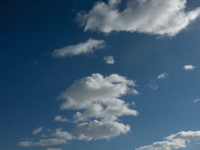
In the situation of this picture a low pressure had been strengthened from the northwest to the eastern side of Finland and northerly winds were picking up. The weather was temporarily allmost clear between two showery precipitation areas, which were associated with the cold air arriving the scene. Only a little amount of cumulus clouds floated in the sky. The appearance of the cumulus clouds in this time of the year during this kind of cold and polaric air mass was a sign of spring, because strengthened radiation of the sun caused stronger upward air flows than before. In other words thermal columns of the air, which is the precondition of the cumulus clouds. As a sign of spring a weak sea breeze kept these clouds away over The Gulf Of Finland, but the picking up northerly wind overruled the effect of it soon. The photo is taken in the district of Tapiola in Espoo towards southeastern sky. Weather condition: choose 19.3.2006; Wetter3 A. Wetter3 B.
Helsingin Puistolan säätilasto maaliskuussa 2006 - Weather chart of Puistola, Helsinki in March 2006.
Flickr 1 Flickr 2

posted by Mika at 2:05 PM
![]()


0 Comments:
Post a Comment
<< Home