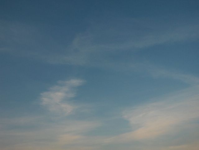
Edellisen kuvan jälkeen 9. - 10. päivinä Pohjois-Skandinaviaan oli kehittynyt pieni matalapaine ja länteen vetäytyneen korkeapaineen tilalla Etelä-Suomeen alkoi ulottua Pohjois-Venäjältä heikko korkeapaineen selänne. Tässä tilanteessa lämmin ilma palasi 9. päiväksi eteläisimpään Suomeen (ylin lämpötila ko. paikalla oli +22,5 astetta), josta se oli 8. päiväksi paennut pohjoiseen ja länteen idästä virranneen viileämmän ilman alta. Kuvauspäivään mennessä em. matalapaine oli voimistunut lännessä hieman ja sen rintamasysteemi oli lähestynyt kuvauspaikkaa. Sen myötä kuvassa oli lisääntyneitä untuvapilviä. Ne on kuvattu Espoon Tapiolassa koillistaivaalle illalla auringon melkein laskiessa, joten pilvissä näkyi jo hieman iltaruskon sävyä. Lähinnä untuvapilviä ja mantereen yllä myös iltapäivän kumpupilviä oli vaihtelevasti edellisen kuvan tilanteen jälkeen joka päivä. Ilman kosteus oli samana aikana melko vähäistä, joten taivaan sinisyys oli yhä voimakasta. Tuulet olivat 9. päivän kohtalaisia koillis-itätuulia lukuun ottamatta hyvin heikkoja. Vain rannikolla oli iltapäivisin vähän voimakkaampaa merituulta. Heikkojen tuulien ja vähäisten pilvien myötä etenkin sisämaassa oli hallaa edellisen ja tämän päivän öinä ilmamassan taas vähän viilennyttyä. Näinäkin päivinä kuitenkin Etelä-Suomen sisämaa-alueilla ylimmät lukemat olivat paikoin n. +20 astetta. Säätilanne: valitse 12.5.2006; Wetter3 A. Wetter3 B.
After the previous picture during the 9th and 10th days a small low pressure had been formed over northern Skandinavia and the high pressure withdrawn to the west was replaced by a weak ridge of high pressure, which started to reach out from northern Russia. In this situation for the 9th day the warm air returned (the maximum reading at this place was +22,5 C) to southernmost Finland, where it had been moved away for the 8th day to the north and west due to the cooler air flowed from the east. Until the photoshooting day the mentioned low pressure had been strengthened in the west and a frontal system associated with it had been approached the photoshooting scene. Due to that there was increased cirrus clouds in the picture. The photo is taken in the district of Tapiola in Espoo towards northeastern sky in the evening as the sun was allmost setting, so there was allready a little sunset colours on the clouds. Mainly the cirrus clouds and over the continent also cumulus clouds appeared in various amounts during every day since the situation of the previous photo. The moisture in the air was small during the same time and therefore the blueness of the sky was further strong. Winds were very weak not counted for the moderate northeasterly-easterly winds in the 9th day. Only by the coast there was a little stronger sea breeze during the afternoons. Due to the calm winds and the small amount of clouds especially in the inland areas there was ground frost at the nights of the previous and this day as the air mass was again a bit cooler. However also during these days in the inland areas of southern Finland the maximum readings were locally about +20 C. Weather condition: choose 12.5.2006; Wetter3 A. Wetter3 B.
Helsingin Puistolan säätilasto toukokuussa 2006 - Weather chart of Puistola, Helsinki in May 2006.
Flickr 1 Flickr 2
Tehoisa lämpösumma - The Effective Temperature Sum: 115,9

posted by Mika at 8:08 PM
![]()


0 Comments:
Post a Comment
<< Home