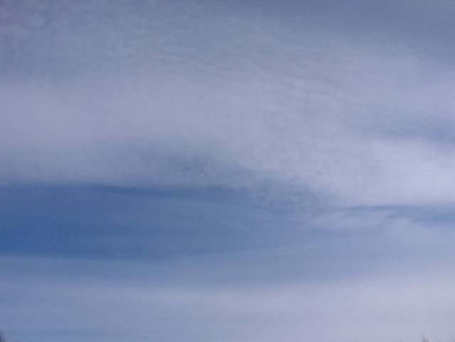
Tässä vaiheessa Suomi oli kapean korkeapaineen selänteen alueella, missä kuvauspaikkakin kuului vielä kylmän talvisen ilmamassan alueeseen; yölämpötila oli -10,8 ja päivälämpötila +1,3 astetta. Lännestä käsin vaikutti kuitenkin heikko lämmin rintama ja siihen liittyen taivaalla oli tässä tilanteessa untuva- ja harsopilviä auringon paistaessa heikosti niiden läpi. Rintama oli osa idän matalapaineen länteen ulottuvaa kylmää rintamaa. Tässä kuvassa nähdään, kuinka em. pilvilajit olivat muuttuneet osaksi palleropilvien kaltaisiksi; aaltomaiset osat kuvan yläreunassa. Kuva on otettu Espoon Tapiolassa itätaivaalle. Säätilanne: valitse 26.3.2006; Wetter3 A. Wetter3 B.
At this stage Finland was in the narrow ridge of high pressure, where the photoshooting scene was also yet in the cold and wintry air mass; the night temperature was -10,8 C and the daytime temperature was +1,3 C. However a weak warm front affected from the west and due to that there were cirrus and cirrostratus clouds in the sky in this situation when the sun shined weakly through them. The front was a part of a cold front that reached to the west from the eastern low pressure. In this picture we see, how these clouds had been changed partly into cirrocumulus type of clouds; the undulating parts on the upper half of the photo. The picture is taken in the district of Tapiola in Espoo towards eastern sky. Weather condition: choose Base Time 26.3.2005; Wetter3 A. Wetter3 B.
Helsingin Puistolan säätilasto maaliskuussa 2006 - Weather chart of Puistola, Helsinki in March 2006.
Flickr 1 Flickr 2

posted by Mika at 12:01 PM
![]()


0 Comments:
Post a Comment
<< Home