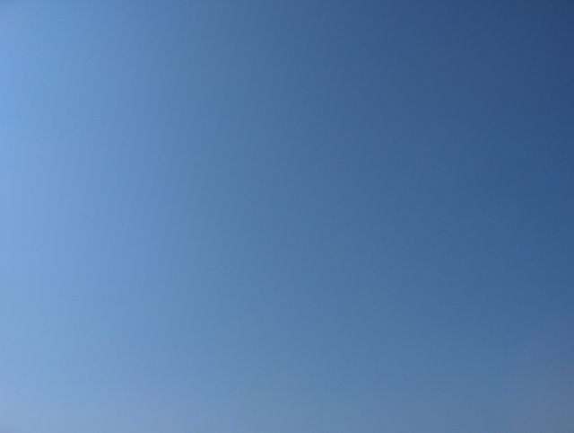
Etelä-Suomi oli edellisen kuvan tilanteesta lähtien helteisessä keskileveysasteiden ilmamassassa. Ilma oli peräisin Länsi-Euroopasta ja se virtasi Suomen eteläpuolelle asettuneen korkeapaineen pohjoispuolitse lännestä ja lounaasta; tuulet olivat aluksi heikkoja, mutta edellisenä ja tänä päivänä tuuli ajoittain melko voimakkaasti. Ylimmät lämpötilat olivat sisämaassa jopa n. +30 astetta paikoin ja merituulten viilentämällä etelärannikolla n. +25 astetta edellisten päivien aikana. Utu lisääntyi hieman ko. päivään mennessä, jolloin kuvassa nähtävä taivaan sinisyys oli aikaisempaa vähän sumeampaa. Ilmamassa oli kuitenkin niin kuivaa korkeapaineen alueella, että pilvisyys oli koko ajan hyvin vähäistä edellisen kuvan tilanteen jälkeen. Kumpupilviäkään ei juuri syntynyt sisämaassa. Sen ja aluksi tyynen sään vuoksi ilman helteisyydestä huolimatta yölämpötilat olivat viileitä; vähän alle +10 astetta. Edellinen yö oli selvästi lämpimämpi (alin lukema oli +12,5 astetta) voimistuneen tuulen vuoksi. Ko. kuvan ottamisen aikana luoteesta oli lähestymässä kylmä rintama, jonka untuvapilvivyöhyke oli nähtävissä kaukana luoteisella taivaanrannalla. Tämä kuva on otettu Espoon Tapiolassa länsitaivaalle. Säätilanne: valitse 14.6.2006; Wetter3 A. Wetter3 B.
Southern Finland was in a hot middle latitude air mass since the situation of the previous picture. The air was originated from western Europe and it flowed from the west and southwest along the northern side of a high pressure settled in the southern side of Finland; winds were weak at first, but during the previous and this day the winds were occasionally rather strong. Maximum temperatures were in inland areas even about +30 C locally and by the southern coast as cooled down by sea breezes about +25 C during the previous days. Haze increased a bit until this day and therefore the blueness of the sky seen in the picture was a little more blurred than before. However the air mass was so dry in the area of the high pressure, that the cloudyness was all the time very minor since the situation of the previous picture. There weren't barely even cumulus clouds appearing in inland areas. Due to that and at first the calm weather despite the hot air the night temperatures were cool; a little less than +10 C. The previous night was clearly warmer (the minimum reading was +12,5 C) due to the strengthened wind. At the time of the photoshoot there was a cold front approaching from the northwest and a band of cirrus clouds related to that was seen far away in the northwestern horizon. This picture is taken in the district of Tapiola in Espoo towards western sky. Weather condition: choose 14.6.2006; Wetter3 A. Wetter3 B.
Helsingin Puistolan säätilasto kesäkuussa 2006 - Weather chart of Puistola, Helsinki in June 2006.
Flickr 1 Flickr 2
Tehoisa lämpösumma - The Effective Temperature Sum: 315,5

posted by Mika at 4:13 PM
![]()


0 Comments:
Post a Comment
<< Home