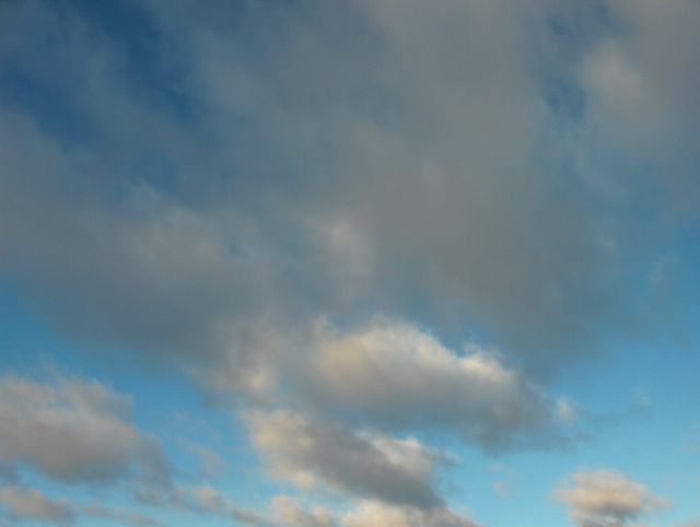
Edellisen yön aikana kylmä rintama ylitti Etelä-Suomen ja melko voimakas pohjoistuuli vallitsi kuvan tilanteessa. Siitä huolimatta sää jopa hieman lämpeni (ylin lämpötila +2,3 astetta) voimistuneen tuulen myötä; ko. ilmamassa oli kiertynyt Norjan vuoriston yli lännestä, jolloin Föhnilmiö vaikutti edelleen. Kun sää lämpenee kylmän rintaman jälkeen, niin ko. rintamaa nimitetään silloin naamioiduksi kylmäksi rintamaksi. Tässä vaiheessa kuivemman polaarisen ilmamassan myötä taivas oli voimakkaan sininen ja sumupilvet olivat kehittyneet kumpupilvien suuntaan. Ne liikkuivat nopeasti tuulessa. Tässä ilmamassassa kumpupilvet ovat hyvin tyypillisiä lämpimämpinä vuodenaikoina, mutta näin leudossa säässä sumupilvet voivat olla kumpupilvien kaltaisia talvellakin. Kuva on otettu Vantaan Tikkurilassa kohti luoteistaivasta. Säätilanne: valitse 27.1.2006; Wetter3 A. Wetter3 B.
During the night before a cold front crossed southern Finland and rather strong northerly wind was prevailing in the situation of the photo. Despite of that the weather got even milder (the maximum temperature +2,3 C) due to a strengthened wind; this air mass had been curved over the mountains of Norway from the west and therefore the Föhn phenomenon was affecting further. When the weather warms up after the cold front, then the front is called a masked cold front. At this stage due to a drier polaric air mass the sky was deep blue and the stratus clouds were progressed towards cumulus clouds. They were moving fast with the wind. In this kind of air mass the cumulus clouds are very typical during warmer seasons, but in such a mild weather stratus clouds can resemble cumulus clouds even in winter. The photo is taken in the district of Tikkurila in Vantaa. Weather condition: choose 27.1.2006; Wetter3 A. Wetter3 B.
Helsingin Puistolan säätilasto tammikuussa 2006 - Weather chart of Puistola, Helsinki in January 2006.
Flickr 1 Flickr 2

posted by Mika at 1:52 PM
![]()


0 Comments:
Post a Comment
<< Home