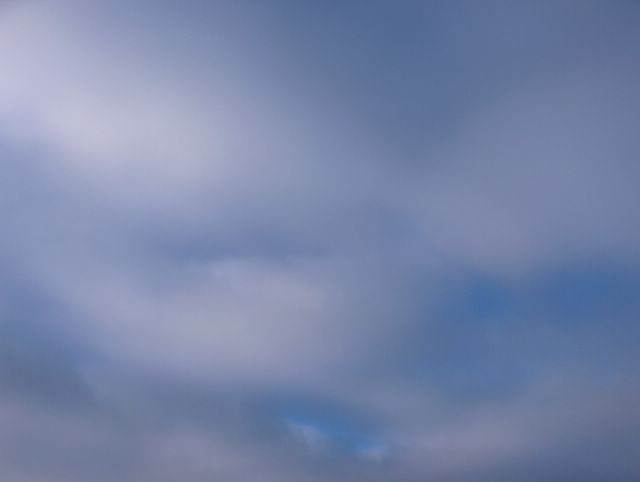
Suomeen ulottui tässä vaiheessa korkeapaine lounaasta ja kaakosta; kuvauspaikka oli tyynessä korkeapaineen selänteessä. Ilmamassa oli edelleen selkeästi useita asteita pakkasella; lämpötila oli alimmillaan -8,9 astetta. Tällaisessa keskileveysasteiden ilmamassan korkeapaineessa kuvan kumpukerrospilvet ovat tyypillisiä loppusyksyllä ja talvella, kuten aikaisemmistakin vastaavan tilanteen kuvista nähdään. Tässä havaitaan silti, kuinka pakkasilmamassassa ko. pilvilaji oli selvästi sumeampi kuin Föhntuulitilanteessa 31. tammikuuta; pilvilaji muistutti nyt sumupilviä. Tämä johtui tämän pilven vesihöyryn kiteisemmästä muodosta. Myös aidot sumupilvet ovat tällaisissa tilanteissa tyypillisiä. Kuva on otettu Espoon Tapiolassa länsitaivaalle. Säätilanne: valitse 10.2.2006; Wetter3 A. Wetter3 B.
At this stage a high pressure was reaching Finland from the southwest and southeast; the location was in the ridge of high pressure. The air mass was further several degrees freezing; the temperature was -8,9 C at lowest. In this kind of high pressure of the middle latitude air mass the stratocumulus clouds of the picture are typical during late autumn and winter in Finland as it's seen from the likewise situations in the previous photos. However in here we see, how during frosty air mass this cloud type was clearly more blurred than in the Föhn wind situation pictured at the 31th of January; the cloud type resembled now stratus clouds. This was due to more crystal form of this cloud's water vapour. Also actual stratus clouds are typical in this kinds of situations. The photo is taken in the district of Tapiola in Espoo towards western sky. Weather condition: choose 10.2.2006; Wetter3 A. Wetter3 B.
Helsingin Puistolan säätilasto helmikuussa 2006 - Weather chart of Puistola, Helsinki in February 2006.
Flickr 1 Flickr 2

posted by Mika at 2:37 PM
![]()


0 Comments:
Post a Comment
<< Home