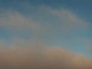
Kuvassa on Helsingin Siltamäessä kuvattua kumpukerrospilveä. Kuvaussuunta oli kohti kaakkoistaivasta ja tässä vaiheessa aurinko oli jo laskenut mailleen. Maassa oli tuore lumikerros ja se vahvisti entisestään tämän tilanteen sinistä valoa myös pilvissä. Lumisissa talvi-illoissa tällainen ns. sininen hetki on usein hyvin voimakas. Sama koskee vastaavia aamuja juuri ennen auringon nousua. Suomen ylle oli siis vahvistunut korkeapaine ja pakkasta oli alimmillaan -8,2 astetta tänä päivänä. Tätäkin pilvilajia esiintyy tyypillisesti lauttoina monissa korkeapaineissa loppusyksyllä ja talvella, kuten sumu- ja hahtuvapilviä. Säätilanne: valitse 27.12.2005; Wetter3 A. Wetter3 B.
In the picture there is stratocumulus clouds captured in the district of Siltamäki in Helsinki. The photoshooting direction was towards southeastern sky and at this moment the sun had been allready set below the horizon. There was fresh snow on the ground and it strengthened further the blue light even in clouds in this situation. During snowy winter evenings this kind of blue moment is in many times very strong. That applys also same kinds of mornings just before the sunrise. As mentioned the high pressure had been formed over Finland and the temperature was -8,2 C at lowest in this day. This kind of cloud type is typically present in layers in many kinds of high pressures during late autumn and winter, like also stratus and altocumulus clouds. Weather condition: choose 27.12.2005; Wetter3 A. Wetter3 B.Helsingin Puistolan säätilasto joulukuussa 2005 - Weather chart of Puistola, Helsinki in December 2005.Flickr 1 Flickr 2 

Tässä tilanteessa leudon jouluaaton jälkeen Suomen yllä oli vallinnut korkeapaine, mutta heikon kaakkoistuulen myötä vielä hyvin vähän jäässä olleelta Suomenlahdelta pääsi vielä kosteutta kuvauspaikalle Vantaan Tikkurilaan, vaikka edellisten päivien matalapaine oli väistynyt etelään. Sen vuoksi kuvassa olevista kumpukerrospilvistä satoi heikosti lunta ja siksi pilvien rakenne näkyi heikosti. Pakkanen oli -8,4 ja -5,7 asteen välillä päivän aikana. Tässäkin tilanteessa nähdään heikosti punertavaa iltaruskosävyä matalalla olleen auringon vuoksi. Kuva on otettu kohti pohjoistaivasta. Säätilanne: valitse 27.12.2005; Wetter3 A. Wetter3 B.
In this situation a high pressure was over Finland, but moisture was transported from still very little frozen The Gulf Of Finland towards the photoshooting scene in the district of Tikkurila in Vantaa with a weak southeasterly wind, allthough the low pressure of the previous days had been moved to the south. Therefore it was snowing slightly from the stratocumulus clouds in the picture and that is why the structure of the clouds was weakly visible. The temperature was between -8,2 C and -6,6 C during the day. In this case also we see slight reddish sunset colour due to the low shining sun. The Picture is taken towards northern sky. Weather condition: choose 27.12.2005; Wetter3 A. Wetter3 B.Helsingin Puistolan säätilasto joulukuussa 2005 - Weather chart of Puistola, Helsinki in December 2005.Flickr 1 Flickr 2
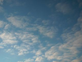 Kuvauspaikkana oli edelleen Vantaan Tikkurila ja kuvaussuunta oli lounaistaivaalle. Tilanteessa vallitsi edelleen kahden matalapaineen välinen korkeapaineen selänne heikkoine tuulineen. Tässä on esimerkki hahtuvapilvestä, joita esiintyy sumupilvien ja kumpukerrospilvien lisäksi lauttoina tähän aikaan vuodesta tässä säätyypissä, missä pilvisyys ei liity säärintamiin. Kuvauspäivänä vallitsi yhä edelleen kylmä sää ja lämpötila vaihteli pilvisyyden mukaan -12,1 ja -5,6 asteen välillä. Säätilanne: valitse 21.12.2005; Wetter3 A. Wetter3 B.The place of the photoshoot was further in the district of Tikkurila in Vantaa (near Helsinki) and shooting direction was towards southwestern sky. In this case a ridge of high pressure with its weak winds was dominating further between two low pressures. In here is an example of altocumulus clouds, which are appearing also in layers like stratus clouds and stratocumulus clouds at this this time of the year during this kind of weather type, where the clouds aren't associated with weather fronts. In the photoshooting day it was still cold and the temperature was between -12,1 C and -5,6 C according to the cloud cover. Weather condition: choose 21.12.2005; Wetter3 A. Wetter3 B.Helsingin Puistolan säätilasto joulukuussa 2005 - Weather chart of Puistola, Helsinki in December 2005.Flickr 1 Flickr 2
 Kuvassa on edelleen samana päivänä kuin viime kuvassa ja Vantaan Tikkurilassa kuvattuja sumupilviä, mutta otettuna hieman eri aikaan keskipäivällä ja kohti lounaistaivasta. Näin ollen punertava iltaruskosävy ei näy aivan yhtä voimakkaana kuin edellisessä kuvassa. Sumupilvien korkeusasema vaikuttaa tähän aikaan voimakkaasti ruskosävyjen voimakkuuteen, koska ko. pilvilaji on kriittisellä korkeudella auringonvaloon nähden. Säätilanne: valitse 20.12.2005; Wetter3 A. Wetter3 B.In the picture there is stratus clouds captured in the same day as in the previous photo and also captured in the district of Tikkurila in Vantaa, but photographed in slightly different time at noon and towards southwestern sky. Therefore the reddish tone of the sunset colours doesn't show as much as in the previous picture. The altitude of the stratus clouds affects greatly to the colours of the sunset, because this cloud type lays at the critical level as opposed to the sunlight. Weather condition: choose 20.12.2005; Wetter3 A. Wetter3 B.Helsingin Puistolan säätilasto joulukuussa 2005 - Weather chart of Puistola, Helsinki in December 2005.Flickr 1 Flickr 2
 Keskipäivälläkin aurinko on Etelä-Suomessa tähän aikaan vuodesta niin matalalla, että alhaalla olevat sumupilvet ovat silloin usein aamu- /iltaruskon kaltaisesti värjäytyneitä kuvan tapaan. Kuvan tilanteessa vallitsi heikkotuulinen korkeapaineen selänne, jossa oli vaihtelevasti sumupilvilauttoja. Ilmamassa oli kuvauspäivänä varsin kylmää ja lämpötila vaihteli lähinnä ko. pilvisyyden mukaan -13,2 ja -5,5 asteen välillä. Ilma oli kylmentynyt Suomen itäpuolelle liikkuneen matalapaineen myötä 16. - 18. joulukuuta. Lämpötilan vuorokausivaihtelu peittyy tähän vuodenaikaan usein pilvisyyden ja tuulen aiheuttamien lämpötilanmuutosten alle, koska auringonsätely on minimaalista. Tällaisessa hyvin heikkotuulisessa tilanteessa pilvisyys aiheuttaa muutoksia lämpötilaan voimakkaimmin. Kuva on otettu kohti luoteistaivasta Vantaan Tikkurilassa. Säätilanne: valitse 20.12.2005; Wetter3 A. Wetter3 B.Even at noon the sun is shining so low in southern Finland during this time of the year, that low lying stratus clouds are coloured like in the times of sunrises or sunsets as seen in the picture. In the situation of the photo there was a ridge of high pressure with weak winds and layers of stratus clouds were variably present. The air mass was rather cold during the day of the photoshoot and the temperature varied between -13,2 C and -5,5 C according to those clouds. The air had been cooled down due to a low pressure that moved to the eastern side of Finland around the 16th and the 18th of december. The cycle of night and daytime temperature is often overshadowed during this time of the year by the changes of temperature caused by the variations in cloudcover and winds, because of the minimal amount of the sun radiation. In this kind of situation with very weak winds the clouds are setting variations to the temperature the strongest. The photo was taken in the district of Tikkurila in Vantaa (near Helsinki) towards northwestern sky. Weather condition: choose 20.12.2005; Wetter3 A. Wetter3 B.Helsingin Puistolan säätilasto joulukuussa 2005 - Weather chart of Puistola, Helsinki in December 2005.Flickr 1 Flickr 2
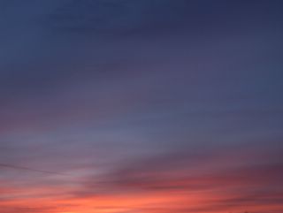
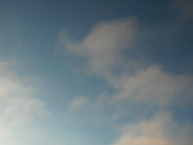
Kuvassa nähdään iltaruskon värjäämää untuva- ja harsopilveä lännestä lähestyneen heikon sadealueen merkkinä (em. okluusiorintama). Myöhemmin illalla satoi heikosti lunta, räntää ja tihkua. Suomessa juuri näin loppusyksyllä - keskitalvella (marras - tammikuussa) voidaan ihastella voimakkaita päiväsaikaisia iltaruskoja usein, koska aurinko paistaa niin matalalta ja säärintamien vyöry lännestä on usein runsasta ja nopeaa. Sumupilvet voivat kuitenkin monesti estää näiden pilvien näkymisen. Kuva on otettu Helsingin Siltamäessä kohti lounaistaivasta. Säätilanne: valitse 14.12.2005; Wetter3 A. Wetter3 B.
In the picture we see cirrus and cirrostratus clouds colored by the sunset as the mark for a weak precipitation area (the mentioned occluded front) incoming from the west. Later in the evening it gave slight snowing, sleet and drizzle. In Finland it is possible to wonder strongly coloured daytime sunsets often during late autumn - midwinter (November-December-January), because the sun is shining so low and weather fronts are usually coming plentifully and fast from the west. However the stratus clouds are many times preventing these clouds from appearing. The photo is taken in the district of Siltamäki in Helsinki towards southwestern sky. Weather condition: choose 14.12.2005; Wetter3 A. Wetter3 B.Helsingin Puistolan säätilasto joulukuussa 2005 - Weather chart of Puistola, Helsinki in December 2005.Flickr 1 Flickr 2
 Kuvattu Vantaan Tikkurilassa kohti lounaistaivasta. Pilvityyppeinä olivat untuvapilvet ja hennot sumupilvet. Kuvaushetkellä vallitsi heikko, mutta voimistuva länsilounainen tuuli ja lännestä oli lähestymässä matalapaine. Sumupilvet liittyivät ilmamassaan, kun tuuli oli heikkoa ja untuvapilvet ennakoivat lännestä lähestynyttä okluusiorintamaa. Rintaman myötä sää lauhtui jälleen vähän suojan puolelle illan loppuun mennessä; ylin lämpötila oli +1,6 astetta. Säätilanne: valitse 14.12.2005; Wetter3 A. Wetter3 B.
Captured in the district of Vantaa (near Helsinki) towards southwestern sky. The cloud types were cirrus and minor stratus clouds. When the picture was taken, there were weak but strengthening west-southwesterly wind and a low pressure was approaching from the west. The stratus clouds were associated with the air mass, when the winds were weak and cirrus clouds were foreseeing an occluded front nearing from the west. Due to the front the weather turned again into little thaw by the end of the evening; the maximum temperature was +1,6 C. Weather condition: choose 14.12.2005; Wetter3 A. Wetter3 B.Helsingin Puistolan säätilasto joulukuussa 2005 - Weather chart of Puistola, Helsinki in December 2005.Flickr 1 Flickr 2
 Kuvattu Vantaan Tikkurilassa lounaistaivaalle. Taivaalla oli sumupilviä etelään liikkuneen kylmän rintaman jälkeen ja korkeapaine oli pohjoisen Skandinavian yllä. Koillistuuli oli juuri tuonut kylmempää (lämpötila laski -5,5 asteeseen päivän aikana) ja kuivempaa ilmaa, mutta vielä jäättömän Suomenlahden vaikutuksesta kosteutta oli tarjolla sumupilville etelärannikolla tässä tilanteessa. Ilmamassa oli kuitenkin sen verran kuivaa (ei ollut utua), että pilvien rakenne näytti selväpiirteiseltä ja tummalta. Säätilanne: valitse 8.12.2005; Wetter3 A. Wetter3 B.Captured in the district of Tikkurila in Vantaa (near Helsinki) towards southwestern sky. In the sky were stratus clouds after a cold front that moved to the south and a high pressure was over northern Skandinavia. A northeasterly wind had just been brought colder (the temperature dropped to -5,5 C during the day) and drier air, but yet iceless The Gulf Of Finland gave enough moisture to the existance of the stratus clouds by the southern coast of Finland in this situation. However the air mass was so dry (there wasn't haze), that the features of the clouds appeared clear and dark. Weather condition: choose 8.12.2005; Wetter3 A. Wetter3 B.
Helsingin Puistolan säätilasto joulukuussa 2005 - Weather chart of Puistola, Helsinki in December 2005.Flickr 1 Flickr 2