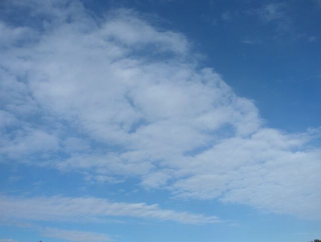
Tässä vaiheessa etelästä oli lähestymässä uusi voimistuva matalapaine. Aikaisemmin iltapäivällä oli edellisen päivän kaltainen tilanne, jossa kuuropilviä kehittyi etenkin sisämaa-alueilla niin Suomessa kuin Virossa. Meren yllä oli lähes selkeää. Kuvassa nähdään kuitenkin ko. matalapaineeseen liittyneen lämpimän rintaman untuva- ja harsopilvivyöhykettä. Myöhemmin illalla tämän perässä saapui myös verho-, pallero-, hahtuva- ja kumpukerrospilviä. Sadealue ei kuitenkaan vielä ennen yötä ulottunut tarkastelupaikalle. Kuvassa nähdään, kuinka untuvapilviin liittyy monesti viirumaisia muotoja. Ne osoittavat yleensä ko. rintamaa kohti, mutta se ei välttämättä kerro rintaman liikesuuntaa samalla tavalla. Tässä tilanteessa itätuuli voimistui ja kuvan pilvikilpi sijoittui lounais-koillissuuntaisesti yli taivaan; matalapaine ohittaisi tarkastelupaikan siten itäpuolitse. Ilmamassa oli tässä tyypillisesti kuivaa ja pilvien muodot näkyivät sen vuoksi vahvan sinisellä taivaalla hyvin. Tämänlainen rintamapilvien lähestyminen on otollinen värikkäälle iltaruskolle ja niinpä tänäkin iltana oli sellainen näytös auringon laskun aikaan n. klo. 22.00 - 23.00. Oleellista kirkkaille ruskoväreille on se, että rintamapilvien on lähestyttävä vastapäätä aurinkoon nähden. Kuvia iltaruskosta en valitettavasti ottanut tällä kertaa. Kuva on otettu kohti kaakkoistaivasta Espoon Tapiolassa. Säätilanne: valitse 31.5.2006; Wetter3 A. Wetter3 B.At this stage there was a new and strengthening low pressure approaching from the south. Earlier in the afternoon there was a similar situation like in the previous day, where cumulonimbus clouds formed especially in inland areas both in Finland and in Estonia. Over the sea there was allmost clear. However in the picture we see a belt of cirrus and cirrostratus clouds associated with a warm front of the mentioned low pressure. Later in the evening after this there arrived also altostratus, cirrocumulus, altocumulus and stratocumulus clouds. However the precipitation area didn't yet reach the observing scene until the night. In the picture we see, how there are many times stripelike shapes in the cirrus clouds. They are usually pointing towards the weather front in question, but they won't reveal the moving direction of the front in the same way. In this case easterly winds were picking up and the shield of clouds was assembling in a southwest - northeast direction over the sky; therefore the low pressure would pass the observing scene from the eastern side. The air mass was typically dry in here and so the shapes of the clouds appeared finely against the strongly blue sky. This kind of weather front related approaching of the clouds is suitable for a colourfull sunset and therefore also in this evening there was such a show during the sunset about 10pm to 11pm. Cruisial for the bright sunset / sunrise colours is the fact, that the frontal clouds must approach from the opposite side compared to the sun. Unfortunately i didn't take pictures of the sunset colours at this time. The picture is taken towards southeastern sky in the district of Tapiola in Espoo. Weather condition: choose 31.5.2006; Wetter3 A. Wetter3 B.Helsingin Puistolan säätilasto toukokuussa 2006 - Weather chart of Puistola, Helsinki in May 2006.
Flickr 1 Flickr 2
Tehoisa lämpösumma - The Effective Temperature Sum: 194,4 
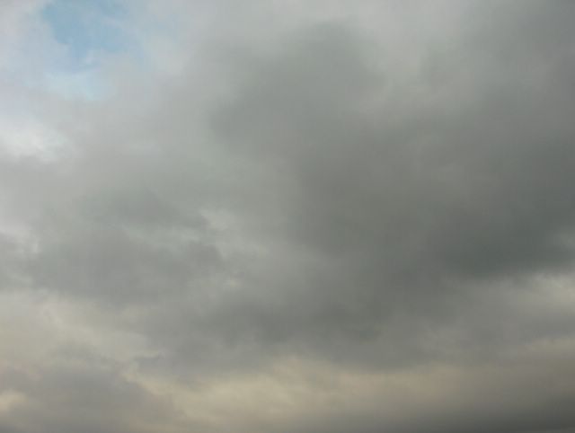
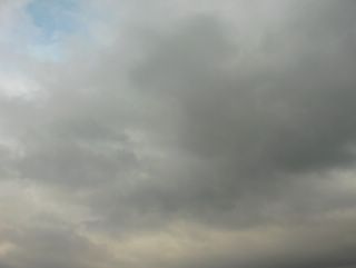
 Tässä ja alemmassa kuvassa oleva kuuropilven jäänne tuli meren (Suomenlahden) yli kuvauspaikalle etelärannikon läheisyyteen, kun Suomen yllä ollut matalapaine oli muotoutunut sen verran sopivasti, että kahtena edellisenä päivänä vaikuttaneet heikot luoteis- ja länsituulet kääntyivät etelään. Tuulet olivat kuitenkin edelleen heikkoja ja kuvaustilanteessa oli jopa tyyntä. Virossa aikaisemmin kehittynyt kuuropilvi liikkui silti tuulen mukana lähemmäksi, mutta näin myöhään illalla ja vielä varsin kylmän meren (n. +10 asteinen) vaikutuksesta sen saama konvektioenergia tyrehtyi ja pilvi alkoi heiketä nopeasti. Siten ei enää tullut sadetta pilven ylittäessä kuvauspaikan. Tällainen etelästä nousevien kuuropilvien heikentyminen on keväällä ja alkukesällä tyypillistä jopa ko. pilvien aktiivisessa kehitysvaiheessa kylmän meren ja merituulen ansiosta. Sen vuoksi myös ukkosta on rannikolla ko. ajankohtana keskimäärin vähemmän kuin Etelä-Suomen sisämaassa. Heikkenevän ja hajoavan kuuropilven tunnusmerkkejä ovat mm. kukkakaalimaisten kumpuosien katoaminen ja kuitumaisen alasinosan (pilven yläosa) leviäminen ja harventuminen yhä laajemmalle taivaalla. Alemmassa kuvassa näkyy vielä hyvin tätä pilven yläsosaa, mutta tässä kuvassa (kuvattu kaakkoistaivaalle) kuuropilvi oli jo hajonnut verhopilviä muistuttavaksi kerrokseksi. Tuo valkoinen hattara on tyypillinen jäänne kuuropilven kumpuosista; niistä jää usein myös hahtuva- ja kumpukerrospilvilauttoja. Säätilanne: valitse 30.5.2006; Wertter3 A. Wetter3 B.The remain of the cumulonimbus cloud in this and the lower picture came across the sea (The Gulf Of Finland) near the southern coast, when the low pressure over Finland had been transformed in such a way, that weak northwesterly and westerly winds of the previous two days turned to the south. However the winds were further weak and during the photoshooting situation it was even calm. The showercloud formed earlier in Estonia moved closer with the wind though, but so late in the evening and due to the yet rather cold sea (about +10 C) the convection energy receaved by the cloud stopped and the cloud started to weaken rapidly. Therefore there wasn't rain anymore as the cloud crossed the photoshooting scene. This kind of weakening of the cumulonimbus clouds risen from the south is typical during spring and early summer even in an actively developing stage of these clouds due to the cold sea and the sea breeze. Because of that there is also on an average less thunder by the southern coast during this period than in the inland areas of southern Finland. The distictive marks of the weakening cumulonimbus cloud are for example disappearance of the cauliflowery cumulus parts and the further spreading and thinning of the fibrous anvil part (the upper part of the cloud) in the sky. In the lower picture there is yet finely seen this upper part of the cloud, but in this photo (photographed towards southeastern sky) the cumulonimbus cloud had allready been scattered into like a layer of altostratus clouds. That white fluffy cloud is a typical remain of the cumulonimbus cloud's cumulus parts; from those also altocumulus and stratocumulus clouds remain many times. Weather condition: choose 30.5.2006; Wertter3 A. Wetter3 B.Helsingin Puistolan säätilasto toukokuussa 2006 - Weather chart of Puistola, Helsinki in May 2006.
Flickr 1 Flickr 2
Tehoisa lämpösumma - The Effective Temperature Sum: 187,3
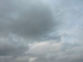
 Tämän päivän kahden kuvan alustukseksi voidaan sanoa samaa kuin blogissa Maisema - Landscape: Edellisen kuvan jälkeen silloinen matalapaine oli edelleen Suomen yllä 27. päivään saakka; seurauksena oli ajoittain kuurottaisia sateita ympäri vuorokauden. Sitten 28. päivän aikana sekä lännestä että kaakosta toiset matalapaineet siirtyivät lähemmäksi Suomea ja yhtyivät yhdeksi suureksi matalapaineeksi Suomen ylle edelliseksi ja täksi päiväksi; tällöin kuurosateet olivat vähentyneet hieman ja keskittyivät nyt enemmän sisämaahan ja kummankin vuorokauden iltapäiviin. Ilmamassa oli koko ajan kuitenkin tavanomaista viileämpää ja edellisen kuvan jälkeen lämpötila oli ylimmillään +15,1 astetta 25. päivänä. Öisin oli aluksi hallatonta tuulten ja pilvien ansiosta, mutta 27. päivän yöstä lähtien tuulet tyyntyivät ja sateet olivat öisin vähäisiä, jolloin vähäpilvisillä alueilla etenkin sisämaassa oli hallaa. Tässä ja ylemmässä kuvassa nähdään samaa kuuropilven jäännettä kuvattuna Espoon Tapiolassa. Tässä kuvaussuunta oli etelätaivaalle. Säätilanne: valitse 30.5.2006; Wetter3 A. Wetter3 B.As for an introduction to this day's two pictures we can say the same as in the blog Maisema - Landscape: After the previous photo the low pressure of that time was further over Finland until the 27th day; that caused occasional showery rain night and day. Then during the 28th day other low pressures both from the west and southeast moved nearer to Finland and fused together into one big low pressure over Finland for the previous and this day; this time showers were decreased a little and they concentrated more into inland areas and in the afternoons of the both days. However the air mass was all the time cooler than the average and after the previous picture the temperature was at highest +15,1 C in the 25th day. At nights there wasn't ground frost at first due to the clouds and the winds, but since the night of the 27th day the winds calmed down and the precipitation was small at nights, so therefore in the places of minor clouds especially in inland areas there was ground frost. In this picture and the picture above we see the same ramain of the cumulonimbus cloud pictured in the district of Tapiola in Espoo. In here the shooting direction of the photo was towards southern sky. Weather condition: choose 30.5.2006; Wetter3 A. Wetter3 B.Helsingin Puistolan säätilasto toukokuussa 2006 - Weather chart of Puistola, Helsinki in May 2006.
Flickr 1 Flickr 2Tehoisa lämpösumma - The Effective Temperature Sum: 187,3
Tämä kuva on otettu n. tuntia myöhemmin kuin edellinen kuva. Kuvauspaikka ja -suunta ovat samat. Tässä nähdään taivaalla edelleen samat sumu- ja kumpukerrospilvet sekoittuneena toisiinsa. Tässä vaiheessa vuotta aurinko oli horisontin yläpuolella myöhään illalla, mutta edelliseen kuvaan verrattuna iltaruskon nähdään lisääntyneen näissä pilvissä jo hieman. Keskitalvella vastaavanlaiset pilvet olisivat näin ruskovärisiä keskellä päivääkin. Ko. päivän sadealueen edellä tuulet olivat kohtalaisia ja heti rintaman ylityksen jälkeen ne heikkenivät tilapäisesti. Yötä kohti etelästä länteen kääntynyt tuuli voimistui kuitenkin nopeasti uudestaan. Samalla paikalle tuli lisää sadekuuroja. Nämä pilvet säilyivät silloinkin taivaalla ja tuulen voimistuessa ne liikkuivat yhä nopeammin pitkin taivasta. Utua oli hieman heti sadealueen jälkeen, mutta se hälveni nopeasti pois tuulen voimistuttua ja viileän polaarisen ilmamassan saavuttua ko. länsituulen myötä. Säätilanne: valitse 23.5.2006; Wetter3 A. Wetter3 B.
This picture is taken about an hour later than the previous picture. The photoshooting scene and direction are the same. In here in the sky we see further the same stratus and stratocumulus clouds mixed up together. At this time of the year the sun was over the horizon late in the evening, but as compared to the previous picture we see the sunset colours increased allready a little in these clouds. In mid winter same kinds of clouds would have such sunset colours even at noon. Before this day's precipitation area winds were moderate and just after the front crossed the area they calmed down temporarily. However towards the night the wind, that turned from the south to the west picked up again fast. At the same time there came more showers to the scene. These clouds remained even then and as the wind got stronger they moved in a yet faster pace across the sky. There was a little haze just after the rain, but it quickly disappeared as the wind got stronger and as the cool polaric air mass came with that westerly wind. Weather condition: choose 23.5.2006; Wetter3 A. Wetter3 B.
Helsingin Puistolan säätilasto toukokuussa 2006 - Weather chart of Puistola, Helsinki in May 2006.
Flickr 1 Flickr 2
Tehoisa lämpösumma - The Effective Temperature Sum: 158,8
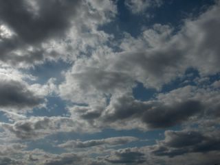
Yllä on kaksi samana iltana otettua kuvaa. Kuvien tilanteessa okluusiorintamaan liittynyt melko runsas kuurottaisen sateen alue oli juuri ylittänyt kuvauspaikan, Espoon Tapiolan. Britteinsaarilla ja pohjoisella Atlantilla oli edellisen kuvan tilanteen jälkeen laaja matalapaine ja sen osakeskuksia liikkui Suomenkin alueella. Niiden myötä kuurottaisia sateita tuli ajoittain ympäri vuorokauden. Tätä päivää edeltävänä päivänä siihen oli kuitenkin poikkeus etelästä ulottuneen korkeapaineen selänteen ansiosta, jolloin oli tilapäisesti lämmintäkin; ylin lämpötila oli +20,0 astetta. Ko päivänä sateen jälkeen taivasta peittivät koko ajan lähes yhtenäisesti sumupilvet, jotka kohosivat ja kehittyivät tyypillisesti osittain kumpukerrospilviksi. Tässä kuvassa niistä nähdään hyvä esimerkki kuvattuna itätaivaalle. Säätilanne: valitse 23.5.2006; Wetter3 A. Wetter3 B.
Above there's two pictures photographed in the same evening. In the situation of the photos a rather heavy showery precipitation area associated with a occluded front had just been passed the photoshooting scene the district of Tapiola in Espoo. After the situation of the previous picture there was a wide low pressure in British Isles and northern Atlantic and subcenters of that were moving around Finland also. Due to them showery rain came occasionally night and day. However in the day before this day there was an exception to that due to a ridge of high pressure reached from the south. At that time it was also temporarily warm; the maximum temperature was +20,0 C. In this day after the rain the sky was blanketed all the time by the stratus clouds allmost evenly. They rose and evolved partly into stratocumulus clouds in a typical way. In this picture we see a fine example of them as pictured towards eastern sky. Weather condition: choose 23.5.2006; Wetter3 A. Wetter3 B.
Helsingin Puistolan säätilasto toukokuussa 2006 - Weather chart of Puistola, Helsinki in May 2006.
Flickr 1 Flickr 2
Tehoisa lämpösumma - The Effective Temperature Sum: 158,8

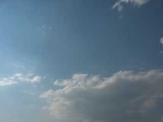
Etelä-Suomen ylle muodostunut pieni korkeapaine oli siirtymässä tässä tilanteessa itään ja Britteinsaarilla ja pohjoisella Atlantilla ollut laaja matalapaine useine keskuksineen lähestyi Suomea. Sen merkkinä etelätuuli alkoi vähitellen voimistua ko. päivänä ja pilvisyys runsastui. Kuvassa nähdään pilvilauttaa, joka koostui hyvin ohuista hahtuvapilvistä. Näitä pilviä esiintyy tyypillisesti minkä tahansa säärintaman lähestyessä kylmän ilmamassan vielä ollessa tarkastelupaikalla. Näiden pilvien mukana on yleensä myös untuva-, pallero-, harso- ja verhopilviä. Yhdessä ne merkitsevät usein lämpimän rintaman lähestymistä ja niin oli käymässä myös tässä tilanteessa. Yöhön mennessä ei kuitenkaan vielä satanut ja koko Suomi oli edelleen kylmän ilman alueella; päivälämpötila oli melko aurinkoisesta säästä huolimatta ko. päivänä vain +12,6 astetta ja yöllä oli ankaraa hallaa ja pakkasta monin paikoin. Illan myötä pilvistyneen sään takia hallaa ei kuitenkaan ollut enää seuraavana yönä. Kuva on otettu Espoon Tapiolassa pohjoistaivaalle. Säätilanne: valitse 18.5.2006; Wetter3 A. Wetter3 B.
A small high pressure formed over southern Finland was moving to the east at this situation and a large low pressure with many centers situated in British Isles and northern Atlantic was nearing Finland. As a mark for that a southerly wind started to pick up slowly during this day and clouds were increasing. In the picture we see a layer of clouds, which was composed of very thin altocumulus clouds. These clouds are appearing typically, when any kind of weather front is approaching as a cold air mass is yet at the observing scene. Among these clouds there are usually also cirrus, cirrocumulus, cirrostratus and altostratus clouds. Together they mark many times the approaching of a warm front and so was the case also in this situation. However it wasn't raining until the night and whole Finland was further in the area of the cold air mass; the afternoon temperature was only +12,6 C in this day despite the rather sunny weather and at night there was severe ground frost and frost in many places. However as the weather got cloudy during the evening there wasn't ground frost anymore during the next night. The picture is taken in the district of Tapiola in Espoo towards northern sky. Weather condition: choose 18.5.2006; Wetter3 A. Wetter3 B.
Helsingin Puistolan säätilasto toukokuussa 2006 - Weather chart of Puistola, Helsinki in May 2006.
Flickr 1 Flickr 2
Tehoisa lämpösumma - The Effective Temperature Sum: 131,4
Kuva on otettu Espoon Tapiolassa kohti länsitaivasta ja kuvassa nähdään kumpukerrospilviksi levinneitä kumpupilviä. Tilanteessa vallitsi heikkenevä, mutta ajankohtaan nähden kylmä pohjoistuuli; iltapäivän lämpötila oli vain +10,9 astetta. Tuulen ja kylmyyden myötä merituulta ei juuri ollut, joten pilvet seilasivat myös meren ylle. Tuulia heikensi Grönlannista Suomen lounaispuolelle ulottunut korkeapaineen selänne, joka siirtyi seuraavaksi yöksi Etelä-Suomen päälle. Sen myötä lähes kaikki pilvet hajaantuivat ja yöstä tuli hyvin kylmä; lämpötila laski 2 metrin korkeudella jopa -2,4 asteeseen. Seuraavana päivänä kumpupilviä esiintyi hyvin vähän sisämaassa. Kylmälle ilmamassalle oli tyypillistä, että taivaan sinisyys oli vahvaa vähäisen kosteuden ansiosta ja kumpupilvien konvektio / termiikki oli heikkoa; pilvet jäivät mataliksi, kun lämpöä ei ollut riittävästi. Pilvet levisivät vaakasuunnassa kumpukerrospilviksi elinkaarensa lopussa, joka aiheutui näiden pilvien yläpuolelle syntyneestä inversiosta. Korkeapaineen alueella tällaisessa ilmamassassa usein käy niin. Lämpimässä ilmamassassa sopivan korkeapaineen alueella näin voi myös olla, kuten 4. toukokuuta kuvatuissa tilanteissa nähdään. Säätilanne: valitse 16.5.2006; Wetter3 A. Wetter3 B.
The picture is taken in the district of Tapiola in Espoo towards western sky and in the picture we see cumulus clouds turned into stratocumulus clouds. In the situation there prevailed calming, but unseasonally cold northerly wind; the afternoon temperature was only +10,9 C. Due to the winds and the coldness there wasn't sea breeze allmost at all, so the clouds drifted also over the sea. The winds were weakened by a ridge of high pressure, which reached southwestern side of Finland from Greenland. It moved over southern Finland the next night. Therefore allmost all clouds disappeared and the night was to be very cold; the temperature dropped in the height of 2 metres even to -2,4 C. During the next day there was very few cumulus clouds in inland areas. It was typical of the cold air mass, that the blueness of the sky was strong due to a small amount of moisture and the convection / thermal of the cumulus clouds was weak; the clouds remained flat as there wasn't enough warmth. The clouds spread in horizontal way into stratocumulus clouds at the end of their lifespan, which was resulted by an inversion formed on the upperside of these clouds. It usually happens in the high pressure during this kind of air mass. In the warm air mass in a suitable high pressure that can also be the case, as we see in the situations pictured in the 4th of May. Weather condition: choose 16.5.2006; Wetter3 A. Wetter3 B.
Helsingin Puistolan säätilasto toukokuussa 2006 - Weather chart of Puistola, Helsinki in May 2006.
Flickr 1 Flickr 2
Tehoisa lämpösumma - The Effective Temperature Sum: 127,5
 Tässä nähdään edellisessä kuvassakin ollutta kuuropilveä etääntyneenä niin, että sen yläosa oli hyvin havaittavissa. Kuva on otettu samalla paikalla kuin edellinenkin kuva, mutta nyt kohti itätaivasta. Näin kylmässä ilmamassassa nämä kuuropilvet eivät kasvaneet kovin korkeiksi, koska niiden käytössä ei ollut niin paljon lämpöenergiaa. Niinpä niiden kumpumuodot eivät olleet esim. kunnon ukkospilven luokkaa ja kuvassakin näkyvä pilvi oli matalahko, vaikka se oli melko voimakas. Vuodenaika oli kuitenkin jo sen verran kesää muistuttava, että kuuroja syntyi kesän tapaan erityisesti iltapäiväksi auringon termiikkiä jo paljon voimistavan vaikutuksen takia. Yöllä tässä tilanteessa oli lähinnä vain näiden kuuropilvien jäänteitä, jotka ovat käytännössä suureksi osaksi kumpukerros- ja hahtuvapilviä. Untuvapilviäkin jää näiden pilvien kuoltua; ne ovat peräisin niiden yläosista. Tämä kylmä polaarinen ilmamassa oli tyypillisesti sen verran kuiva (ei utua), että taivaan sinisyys oli edelleen vahvaa ja pilvien muodot olivat selkeästi esillä. Säätilanne: valitse 15.5.2006; Wetter3 A. Wetter3 B.In here we see the shower- / cumulonimbus cloud appeared also in the previous photo withdrawn in a such way, that the upper part of it was clearly visible. The picture is taken in the same location as the previous picture, but now towards eastern sky. In such a cold air mass these showerclouds didn't grow very high, because there wasn't so much heat energy to use by them. Therefore the cumulus shapes of them weren't in the same league as in the proper thundercloud and also the cloud in the picture was low, allthough it was rather heavy. However the season resembled allready summer in such a way, that the showers appeared in a summery way especially in the afternoon due to the very much strengthened affection of the sun to the thermal. At night there was mainly remains of these shower clouds, which are in practise mainly stratocumulus and altocumulus clouds. Cirrus clouds are also left from these clouds as they have died; they are originated from the upper parts of them. This cold polaric air mass was typically so dry (no haze), that the blueness of the sky was further strong and the shapes of the clouds were clearly visible. Weather condition: choose 15.5.2006; Wetter3 A. Wetter3 B.Helsingin Puistolan säätilasto toukokuussa 2006 - Weather chart of Puistola, Helsinki in May 2006.
Flickr 1 Flickr 2
Tehoisa lämpösumma - The Effective Temperature Sum: 125,8
 Täksi päiväksi koko Suomen oli vallannut aikaisempaa huomattavasti kylmempi luoteis-pohjoistuuli voimakkaine puuskineen; päivälämpötila jäi nyt vain +9,6 asteeseen, mutta tuulen ja pilvien vuoksi matala yölämpötila ei merkinnyt tässä vaiheessa hallaa. Tuulen aiheutti lännessä edellisessä tilanteessa ollut matalapaine, joka liikkui 13. ja 14. päivinä Suomen yli koilliseen voimistuen samalla. Niinpä sen jälkipuolella Pohjoisnavalta saakka pääsi kylmää ilmaa myös kuvauspaikalle Espoon Tapiolaan. Tämä tiesi 13. päivästä eteen päin sadekuuroja ja runsasta kuuropilvisyyttä; myös vaihtelevasti kumpukerros- ja hahtuvapilviä. Kylmän rintaman ylityksen aikana 13. päivänä myös verho-, harso- ja untuvapilviä esiintyi. Sadekuuroja oli monta etenkin kuvauspäivänä ja kuvassa nähdään erästä melko voimakasta kuuropilveä ja sen erikoisia ns. mammatusmuotoja. Mammatusmuotoja esiintyy yleensä vain voimakkaissa ukkospilvissä, mutta tässä pilvessä ei ollut ukkosta. Nämä muodot johtuvat kylmän ja kostean ilman valumisesta kuuropilven yläosasta alaspäin ja samalla alhaalla oleva lämpimämpi ilma nousee (termiikki eli konvektio) ko. kylmään ilmaan muodostaen "välejä". Tyypillisesti ne esiintyvät kuuro- ja ukkospilven jälkipuolella. Kuva on otettu kaakkoistaivaalle ja samaa pilveä esiintyy myös blogini Maisema - Landscape saman ko. päivän kolmen kuvan sarjassa. Säätilanne: valitse 15.5.2006; Wetter3 A. Wetter3 B.Until this day whole Finland had been invaded by a much colder northwesterly-northerly wind than before with strong gusts; the afternoon temperature stayed only at +9,6 C, but due to the wind and the clouds the low night temperature didn't mean ground frost at this stage. The wind was resulted by the low pressure situated in the west in the previous situation. This low pressure crossed Finland to the northeast during 13th and 14th days strengthening at the same time. So in the afterside of it air flowed all the way from the North Pole also to the photoshooting scene in the district of Tapiola in Espoo. This meant showers and plentyfull cumulonimbus cloudyness from the 13th day onwards; also variably stratocumulus and altocumulus clouds. At the time of the crossing cold front at the 13th day also altostratus, cirrostratus and cirrus clouds appeared. There were plenty of showers especially during the photoshooting day and in the picture we see one rather heavy shower- /cumulonimbus cloud and so called mammatus shapes of it. The mammatus shapes appear usually in severe thunder clouds, but in this cloud there wasn't thunder. These shapes are resulted by the cold and moist air flowing downwards from the upper parts of the cumulonimbus cloud as at the same time warmer air underneath is rising (the thermal or convection) into the upper cold air forming "gaps". Typically they appear in the afterside of the shower- / cumulonimbus cloud. The picture is taken towards southeastern sky and the same shower cloud appears also in my blog Maisema - Landscape in the three picture series in this same day. Weather condition: choose 15.5.2006; Wetter3 A. Wetter3 B.Helsingin Puistolan säätilasto toukokuussa 2006 - Weather chart of Puistola, Helsinki in May 2006.
Flickr 1 Flickr 2
Tehoisa lämpösumma - The Effective Temperature Sum: 125,8
 Edellisen kuvan jälkeen 9. - 10. päivinä Pohjois-Skandinaviaan oli kehittynyt pieni matalapaine ja länteen vetäytyneen korkeapaineen tilalla Etelä-Suomeen alkoi ulottua Pohjois-Venäjältä heikko korkeapaineen selänne. Tässä tilanteessa lämmin ilma palasi 9. päiväksi eteläisimpään Suomeen (ylin lämpötila ko. paikalla oli +22,5 astetta), josta se oli 8. päiväksi paennut pohjoiseen ja länteen idästä virranneen viileämmän ilman alta. Kuvauspäivään mennessä em. matalapaine oli voimistunut lännessä hieman ja sen rintamasysteemi oli lähestynyt kuvauspaikkaa. Sen myötä kuvassa oli lisääntyneitä untuvapilviä. Ne on kuvattu Espoon Tapiolassa koillistaivaalle illalla auringon melkein laskiessa, joten pilvissä näkyi jo hieman iltaruskon sävyä. Lähinnä untuvapilviä ja mantereen yllä myös iltapäivän kumpupilviä oli vaihtelevasti edellisen kuvan tilanteen jälkeen joka päivä. Ilman kosteus oli samana aikana melko vähäistä, joten taivaan sinisyys oli yhä voimakasta. Tuulet olivat 9. päivän kohtalaisia koillis-itätuulia lukuun ottamatta hyvin heikkoja. Vain rannikolla oli iltapäivisin vähän voimakkaampaa merituulta. Heikkojen tuulien ja vähäisten pilvien myötä etenkin sisämaassa oli hallaa edellisen ja tämän päivän öinä ilmamassan taas vähän viilennyttyä. Näinäkin päivinä kuitenkin Etelä-Suomen sisämaa-alueilla ylimmät lukemat olivat paikoin n. +20 astetta. Säätilanne: valitse 12.5.2006; Wetter3 A. Wetter3 B.After the previous picture during the 9th and 10th days a small low pressure had been formed over northern Skandinavia and the high pressure withdrawn to the west was replaced by a weak ridge of high pressure, which started to reach out from northern Russia. In this situation for the 9th day the warm air returned (the maximum reading at this place was +22,5 C) to southernmost Finland, where it had been moved away for the 8th day to the north and west due to the cooler air flowed from the east. Until the photoshooting day the mentioned low pressure had been strengthened in the west and a frontal system associated with it had been approached the photoshooting scene. Due to that there was increased cirrus clouds in the picture. The photo is taken in the district of Tapiola in Espoo towards northeastern sky in the evening as the sun was allmost setting, so there was allready a little sunset colours on the clouds. Mainly the cirrus clouds and over the continent also cumulus clouds appeared in various amounts during every day since the situation of the previous photo. The moisture in the air was small during the same time and therefore the blueness of the sky was further strong. Winds were very weak not counted for the moderate northeasterly-easterly winds in the 9th day. Only by the coast there was a little stronger sea breeze during the afternoons. Due to the calm winds and the small amount of clouds especially in the inland areas there was ground frost at the nights of the previous and this day as the air mass was again a bit cooler. However also during these days in the inland areas of southern Finland the maximum readings were locally about +20 C. Weather condition: choose 12.5.2006; Wetter3 A. Wetter3 B.Helsingin Puistolan säätilasto toukokuussa 2006 - Weather chart of Puistola, Helsinki in May 2006.
Flickr 1 Flickr 2
Tehoisa lämpösumma - The Effective Temperature Sum: 115,9
 Edellisten kahden kuvan tilanteen jälkeen Suomen yllä vaikutti pitkään korkeapaine, jonka alueella vallitsi ajankohtaan nähden erittäin lämmin mantereinen keskileveysasteiden ilmamassa. Sen myötä päivälämpötilat olivat Etelä-Suomen sisämaassa jopa hellelukemissa (vähän yli +25 astetta) n. kolmena päivänä, mutta ilmamassan kuivuuden, selkeän sään ja heikon tuulen vuoksi lämpötilan vuorokausivaihtelu oli hyvin suuri; yölämpötilat olivat n. +5 astetta. Joka iltapäivä vaikuttaneen merituulen takia etelärannikon päivälämpötilat olivat "vain" +20 - +25 astetta. Ilmamassan kuivuminen edellisen tilanteen jälkeen merkitsi iltapäivän kumpupilvien vähenemistä ja ajoittain oli missä vaiheessa päivää tahansa täysin selkeääkin. Lähinnä vain untuvapilviä esiintyi. Kuvauspäiväksi idästä oli virrannut vähän viileämpää ilmaa korkeapaineen heikennyttyä ja vetäydyttyä vähän länteen; ko. paikan ylin lämpötila oli nyt +17,2 astetta. Viileämmän ilmamassan etureunassa oli heikko kylmärintama, joka jäi tänä päivänä Etelä-Suomen ylle koillis - lounaissuunnassa. Siihen liittyi kuvassa nähtäviä untuvapilviä aikaisempaa hieman runsaammin, mutta ei juuri muuta (vähän harso- ja verhopilviäkin). Tässä vaiheessa taivaan sinisyys oli näkynyt jo useana päivänä melko voimakkaasti udun vähäisyyden vuoksi (kuiva ilmamassa). Kuva on otettu Espoon Tapiolassa länsitaivaalle. Säätilanne: valitse 8.5.2006; Wetter3 A. Wetter3 B.After the situation in the previous two pictures the high pressure affected over Finland for a long time and in that area an unseasonally very warm continental middle latitude air mass prevailed. Due to that the afternoon temperatures were even a bit over +25 C (considered as a heatwave in Finland) in the inland areas of southern Finland during about three days, but due to the drieness of the air mass, clear skies and calm winds the cycle of night and daytime temperature was large; the night temperatures were about +5 C. Due to the every afternoon affected sea breeze the daytime temperatures were by the southern coast "only" from +20 C to +25 C. The drying up of the air mass after the previous situation meant decreasing of the afternoon cumulus clouds and occasionally it was also completely clear at any time of the day. Mainly cirrus clouds were appearing. For the photoshooting day there was a bit cooler air flowed from the east as the high pressure had been weakened and moved a little to the west; the maximum temperature in this place was now +17,2 C. In the foreside of the cooler air mass there was a weak cold front, that stayed during this day over southern Finland along the direction of northeast - southwest. In there the cirrus clouds seen in the picture were associated a bit more than before, but hardly nothing else (a little cirrosstratus and also altostratus clouds). At this stage the blueness of the sky had been appearing rather strongly allready in many days due to a little amount of haze (the dry air mass). The picture is taken in the district of Tapiola in Espoo towards western sky. Weather condition: choose 8.5.2006; Wetter3 A. Wetter3 B.Helsingin Puistolan säätilasto toukokuussa 2006 - Weather chart of Puistola, Helsinki in May 2006.
Flickr 1 Flickr 2
Tehoisa lämpösumma - The Effective Temperature Sum: 86,6
 Tämä kuva on otettu samana iltapäivänä Espoon Tapiolassa kuin edellinen kuva, mutta nyt kohti luoteistaivasta. Kuvassa nähdään sama kumpupilvitilanne, missä myös edellisessäkin kuvassa ko. pilvilajin nähdään muuntuneen hieman kumpukerrospilvien suuntaan. Tämä on tyypillistä korkeapaineen alueella, jossa ilman vertikaalinen liike ylhäältä alas päin ehkäisee termiikin voimaa ylöspäin. Tämän vuoksi etenkin kumpupilvien elinkaaren loppuvaiheessa ne leviävät ja latistuvat hieman ennen illan katoamistaan. Tänä vuodenaikana termiikki ei ole vielä voimakkaimmillaan, joten kesällä tällaisessa keskileveysasteiden ilmamassassa termiikki voi olla niin voimakas, että korkeapaineen alueellakin osa kumpupilvistä voi kasvaa sisämaassa ukkospilviksi saakka. Tällöin puhutaan ns. lämpöukkosista. Monesti kumpupilvien esiintyminen on vähäistä kesällä Suomessa olevassa keskileveysasteiden ilmamassassa myös siksi, koska niiden kehitys ukkos- ja kuuropilviksi asti tapahtuu niin nopeasti. Nyt tämä ilmamassa oli lisäksi hieman kuivunut aikaisemmista päivistä (utu oli vähentynyt), joka heikensi termiikkipilviä. Ilmamassa lämpeni tässä vaiheessa edelleen myös korkeapaineen keskuksen alueella, koska ilmaa syöttyi alueelle korkeapaineen länsi- ja eteläpuolella vallinneiden lämpimien tuulien myötä. Merituulen vuoksi iltapäivän lämpötila oli tällä paikalla +19,1 astetta, mutta sisämaassa jo reilusti yli +20 astetta. Edellinen yö oli vielä hallayö etenkin sisämaassa tyynen ja selkeän sään vuoksi, mutta ilmamassan jatkuvan lämpenemisen vuoksi seuraava yö oli jo lämpimämpi. Säätilanne: valitse 4.5.2006. Wetter3 A. Wetter3 B.This picture is taken in the same afternoon in the district of Tapiola in Espoo as the previous picture, but now towards northwestern sky. In the picture we see the same cumulus cloud situation, where also in the previous picture we see this cloud type transformed a bit into stratocumulus clouds. This is typical in the area of a high pressure, where the vertical movement of the air downwards is preventing the upward force of the thermal. Due to this at the end of the lifecycle of the cumulus clouds, they often spread and flag before they disappear in the evening. In this time of the year the thermal isn't the most forcefull yet, so in summer during this kind of middle latitude air mass the thermal can be so forcefull, that even in the area of a high pressure some of the cumulus clouds can evolve all the way into shower- and thunderlouds (cumulonimbus clouds). In that situation a so called heat thunderstorm term is in use (in Finland). Many times the appearing of the cumulus clouds in summer is also minor during a middle latitude air mass in Finland, because they evolve so fast into shower- and thunderclouds. Now this air mass was also dried (haze was decreased) since the previous days, which weakened the thermal clouds. At this stage the air mass was further warming up also in the center of the high pressure, because air was feeding into the area due to the prevailing warm winds around the southern and western sides of the high pressure. Due to the sea breeze the afternoon temperature was +19,1 C in this place, but in inland areas allready clearly more than +20 C. The last night was yet ground frost filled especially in the inland areas due to the clear sky and calm winds, but the next night was allready warmer due to a continuingly warming air mass. Weather condition: choose 4.5.2006; Wetter3 A. Wetter3 B.Helsingin Puistolan säätilasto toukokuussa 2006 - Weather chart of Puistola, Helsinki in May 2006.
Flickr 1 Flickr 2
Tehoisa lämpösumma - The Effective Temperature Sum: 47,9
 Idässä pitkään olleen korkeapaineen keskus oli nyt siirtynyt Lounais-Suomen päälle. Sen myötä yleinen tuulitilanne oli tyyntynyt, jolloin sisämaa-alueilla tuulet olivat hyvin heikkoja ja etenkin yöllä oli myös täysin tyyntä. Iltapäivällä tässä tilanteessa etelärannikolla syntyi kuitenkin vahva merituulitilanne, jossa Suomenlahdelta virisi ajoittain kohtalainen etelätuuli. Tämä säätilanne suosi mantereen yllä iltapäivän kumpupilvien kehittymistä, kun termiikki oli vahvaa maan pinnan tehokkaan lämpenemisen vuoksi. Kuvassa kumpupilviä nähdään kuvattuna Espoon Tapiolassa kohti koillistaivasta. Pilvien reuna näkyy kuvassa hyvin, koska merituuli esti ko. pilvien syntymisen meren yllä ja n. 2 - 10km sisämaahan päin rannikolla. Korkeapaineen keskuksen oltua Lounais-Suomen yllä pilvet liikkuivat tässä ko. päivänä länsiluoteesta päin (ilma kiertää pohjoisella pallonpuoliskolla korkeapaineen keskusta myötäpäivään ja matalapaineen keskusta vastapäivään), mutta meren lähelle tultuaan ne haihuivat pois kohdatessaan merituulirintaman. Säätilanne: valitse 4.5.2006; Wetter3 A. Wetter3 B.The center of the high pressure situated for a long time in the east had now been moved over southwestern Finland. Due to that the general wind situation had been calmed down, where in the inland areas the winds were very weak and especially at night it was also completely calm. However in the afternoon there was born a strong sea breeze situation by the southern coast, where an occasionally moderate southerly wind came from The Gulf Of Finland. This weather situation favoured the forming of afternoon cumulus clouds over the continent, as the thermal was strong due to an effective warming of the ground. In the picture we see the cumulus clouds pictured in the district of Tapiola in Espoo towards northeastern sky. The edge of these clouds is seen in the picture well, because the sea breeze prevented them to appear over the sea and about 2 to 10 kilometres towards the inland by the coast. As the center of the high pressure was over southwestern Finland, the clouds were moving here during this day from the west-northwest (in northern hemisphere the air circulates clockwise around the center of a high pressure and counterclockwise around a low pressure), but when they approached the sea they evaporated away as they met the sea breeze front. Weather condition: choose 4.5.2006; Wetter3 A. Wetter3 B.Helsingin Puistolan säätilasto toukokuussa 2006 - Weather chart of Puistola, Helsinki in May 2006.
Flickr 1 Flickr 2
Tehoisa lämpösumma - The Effective Temperature Sum: 47,9
 Edellisessäkin kuvassa vaikuttanut korkeapaine oli nyt yhä enemmän muotoutumassa Suomen ylle ja sen myötä Suomen päälle lännestä täksi päiväksi saapunut okluusiorintama kuoli vähitellen pois ja edellisten parin päivän kohtalaiset etelätuulet heikkenivät. Yhä heikkenevästä rintamasta oli jäljellä enää lähinnä verho- ja harsopilviä. Kuvassa niiden nähdään muuntuneen paikoin pallero- ja hahtuvapilvien suuntaan, joita esiintyy tyypillisesti tällaisissa tilanteissa ja näiden pilvien kanssa etenkin lämpiminä vuodenaikoina. Ajoittain oli vielä myös kuuropilvien suuntaan vähän pullistuneita kumpukerrospilviä. Utu sumensi edelleen vähän näkymää. Tuulten heikkenemisen myötä ilmamassa ei lakannut lämpenemästä; nyt päivän ylin lukema oli +17,0 astetta ja Etelä-Suomen sisämaa-alueilla oli paikoin yli +20 astetta. Näinä kahtena melko pilvisenä päivänä merituulta ei tosin päässyt kunnolla muodostumaan, mutta tuulen suunta oli valmiiksi etelästä vielä kylmän (vain muutamia plusasteita) Suomenlahden yli. Pilvien ansiosta edellinen yö oli melko lämmin; alin lukema oli +6,5 astetta. Kuva on otettu Espoon Tapiolassa etelätaivaalle. Säätilanne: valitse 3.5.2006; Wetter3 A. Wetter3 B.The high pressure affected also in the previous picture was now further more shaping over Finland and due to that the occluded front brought on over Finland for this day died slowly away and the moderate southerly winds of previous couple of days were calming down. There were mainly altostratus and cirrostratus clouds left from the further weakening front. In the picture we see them transformed locally into cirrocumulus and altocumulus clouds, which appear typically with these clouds in these kinds of situations especially during warm seasons. Occasionally there was yet also stratocumulus clouds bulged a little into cumulonimbus clouds. Haze blurred the scene further a little bit. Due to the calming of the winds the air didn't stop warming; now the maximum reading of the day was +17,0 C and in the inland areas of southern Finland locally over +20 C. During these two rather cloudy days the sea breeze didn't appear properly though, but the direction of the wind was allready from the south over yet cold (only couple of degrees over zero C) The Gulf Of Finland. Due to the clouds the last night was fairly warm; the minimum reading was +6,5 C. The picture is taken in the district of Tapiola in Espoo towards southern sky. Weather condition: choose 3.5.2006; Wetter3 A. Wetter3 B.Helsingin Puistolan säätilasto toukokuussa 2006 - Weather chart of Puistola, Helsinki in May 2006.
Flickr 1 Flickr 2
Tehoisa lämpösumma - The Effective Temperature Sum: 40,7
 Tämä päivä oli pilvisyydeltään vaihteleva. Lähinnä vain untuva- ja harsopilviä esiintyi aluksi, mutta illalla lännestä lähestyneen vanhan ja heikkenevän okluusiorintaman runsas pilvisyys saapui kuvauspaikallekin. Tällöin kuvassa näkyvät kumpukerrospilvet ja hahtuvapilvet peittivät taivaan ajoittain melkein kokonaan. Jotkut osat kumpukerrospilvistä olivat kehittyneet heikoiksi kuuropilviksi tai itse asiassa ne olivat ko. rintaman heikkenevien sateiden jäänteitä; kuvassa nähdään heikkoja sadejuovia erään tällaisen pilven alla. Kuvauspaikallekaan ei silti saatu käytännössä ollenkaan sadetta. Ko. rintaman itäpuolella Suomeen virtasi etelästä yhä lämpimämpää ilmaa ja tänä päivänä ylin lämpötila oli +15,5 astetta huolimatta edellistä päivää runsaammasta pilvisyydestä. Utuakin oli ilmassa ja kuvassa se havaitaan noiden pilvien sinertävästä ja alempana taivaanrannassa myös ruskehtavasta sävystä; kyseessä ei vielä ollut iltaruskosävy, koska aurinko oli näinkin myöhään illalla vielä melko korkealla. Kesällä tällaisessa säätilanteessa olisi ukkosta. Kuva on otettu Espoon Tapiolassa koillistaivaalle. Säätilanne: valitse 2.5.2006; Wetter3 A. Wetter3 B.During this day cloudyness was variable. At first mainly cirrus and cirrostratus clouds appeared, but in the evening plentyfull cloudyness of a old and weakening occluded front came also over the photoshooting scene. Then these stratoculumus and altocumulus clouds in the picture shadowed the sky occasionally allmost completely. Some parts of the stratocumulus clouds had been transformed into weak cumulonimbus clouds or actually they were remains of a weakening precipitation area associated with the mentioned front; in the picture we see weak rain stripes under one this kind of cloud. However also at the photoshooting scene as well there wasn't rain practically at all. On the eastern side of that front warmer air streamed further into Finland from the south and in this day the maximum temperature was +15,5 despite the more plentyfull cloudyness than in the previous day. There was also haze in the air and in the photo we can observe it from the blueish colour of those clouds and lower in the horizon also from the brownish colour tone; this wasn't yet sunset colour, because the sun was yet in a rather high position even so late in the evening. In summer during this kind of weather situation there would be thunder. The picture is taken in the district of Tapiola in Espoo towards northeastern sky. Weather condition: choose 2.5.2006; Wetter3 A. Wetter3 B.Helsingin Puistolan säätilasto toukokuussa 2006 - Weather chart of Puistola, Helsinki in May 2006.
Flickr 1 Flickr 2
Tehoisa lämpösumma - The Effective Temperature Sum: 33,6
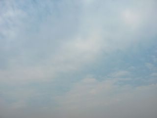
 Suomen itäpuolella jo useita päiviä ollut korkeapaine oli nyt siirtymässä enemmän Suomen päälle. Täksi päiväksi korkeapaine oli muotoutunut niin, että sen länsireunaa pitkin virtasi ilmaa etelästä aikaisempaa kauempaa. Tällöin ilmamassa oli edelleen lämpenemässä ja ylin lämpötila oli ko. päivänä jo +14,1 ja sisämaa-alueilla selvästi yli +15 astetta. Yö oli kuitenkin vielä hallainen selkeän sään vuoksi. Tässä vaiheessa lännestä lähestyi säärintamia pilvineen. Ne eivät vielä ulottuneet kuvauspaikalle, vaan taivas oli tyystin selkeä. Ilmamassan virtaaminen yhä etelämpää ja sen muodostuminen yhä enemmän keskileveysasteiden ilmamassaksi aiheutti kuitenkin udun lisääntymistä, joka havaitaan tässä vertaamalla kuvaa 24. huhtikuuta otetussa kuvassa olleeseen selkeään taivaaseen. Tämä kuva on otettu Espoon Tapiolassa länsitaivaalle. Säätilanne: valitse 1.5.2006; Wetter3 A. Wetter3 B.The high pressure situated allready for several days in the eastern side of Finland was now moving more over Finland. For this day the high pressure had been shaped in such a way, that along the western side of it air flowed from further south than before. Therefore the air mass was further warming up and the maximum temperature was in this day allready +14,1 C and in inland areas clearly over +15 C. However the night was yet ground frost filled due to the clear weather. At this stage there were weather fronts approaching from the west with clouds. They didn't reach the photoshooting scene yet and so the sky was completely clear. However the flowing of the air further south and the air being formed more into middle latitude air mass caused increasing of haze, which can be observed here when comparing the picture with the clear sky in the picture taken in 24th of april. This photo is taken in the district of Tapiola in Espoo towards western sky. Weather condition: Choose 1.5.2006; Wetter3 A. Wetter3 B.Helsingin Puistolan säätilasto toukokuussa 2006 - Weather chart of Puistola, Helsinki in May 2006.
Flickr 1 Flickr 2
Tehoisa lämpösumma - The Effective Temperature Sum: 28,7