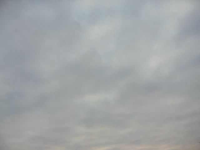
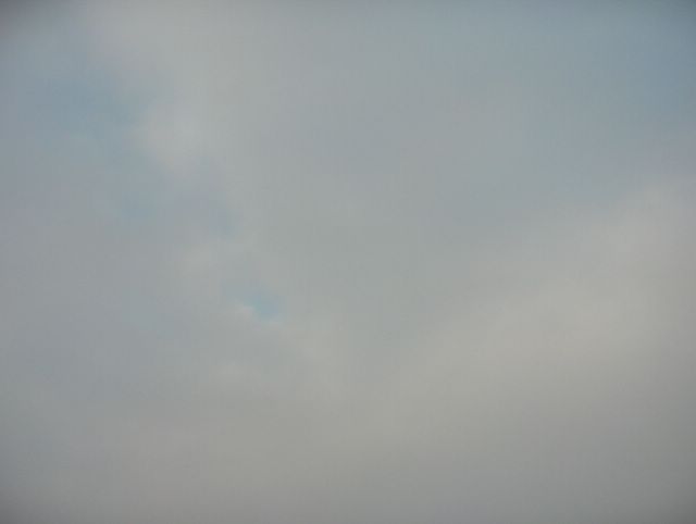
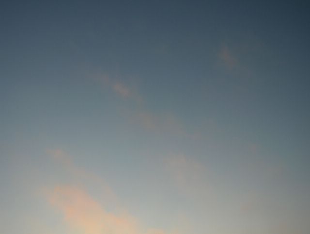
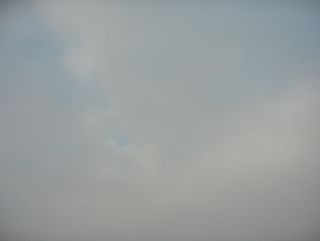
Seuraavana aamuna edellisen päivän (kuvan) kylmä rintama oli muuttunut lämpimäksi rintamaksi luoteesta lähestyneen uuden matalapaineen vaikutuksesta. Tässä vaiheessa kuvauspaikka oli rintaman kylmemmällä puolella. Föhntuuli oli tyyntynyt ja lakannut vaikuttamasta; pakkasta oli aamulla alimmillaan -10,0 astetta. Nyt taivaalla oli pohjois-eteläsuuntaisesti lähestyneen uuden säärintaman verho- ja hahtuvapilviä laajana kilpenä. Pilvissä nähdään vähän myös auringon kajoa, koska pilvikilpi rajautui selkeään kaakkoistaivaaseen. Kuva on otettu Vantaan Tikkurilassa kohti kaakkoistaivasta. Säätilanne: valitse 31.1.2006; Wetter3 A. Wetter3 B.In the next morning the cold front of the previous day (picture) had been turned into a warm front due to a low pressure, that approached from the northwest. At this stage the location of the photoshoot was on the colder side of the front. The Föhn wind had been died out and was no longer effective; the temperature was -10,0 C at lowest in the morning. Now there were a wide shield of altostratus and altocumulus clouds of the new and nearing north - south lined weather front in the sky. In the clouds we see also some glow of the just risen morning sun, because the boundary of the cloud shield was lined with the clear sky on the east horizon. The photo is taken in the district of Tikkurila in Vantaa (near Helsinki) towards southeastern sky. Weather condition: choose 31.1.2006; Wetter3 A. Wetter3 B.Helsingin Puistolan säätilasto tammikuussa 2006 - Weather chart of Puistola, Helsinki in January 2006.Flickr 1 Flickr 2
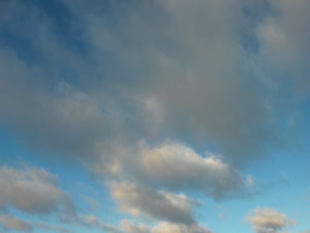
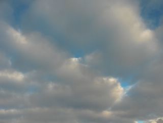 Föhnilmiö oli voimakkaimmillaan tässä vaiheessa ja lämpötila oli ylimmillään päivän aikana +3,7 astetta. Vallinneessa luoteistuulessa liikkui nyt ko. tilanteelle tunnusomaisia kumpukerrospilviä lauttoina. Kuvassa on niistä hyvä esimerkki. Tilanteessa taivas oli myös hyvin sininen kuivan ilmamassan vuoksi. Toisaalta nämä pilvet liittyivät myös kylmään rintamaan (sen jälkipuoleen), johon Föhntuuli lopulta päättyi. Rintama sijaitsi luode - kaakkosuuntaisesti lounaisen Suomen yllä kuvan ottamisen aikaan. Kuva on otettu Vantaan Tikkurilassa kohti koillistaivasta. Säätilanne: valitse 30.1.2006; Wetter3 A. Wetter3 B.The Föhn phenomenon was at its peak in this situation and the temperature was +3,7 C at highest during the day. With the prevailing northwesterly wind there were now layers of moving stratocumulus clouds, which were typical of the situation. In the picture there's a fine example of them. The sky was also very blue in the situation due to the dry air mass. On the other hand these clouds were associated also with a cold front (with the backside of it), what finally ended the Föhn wind. The front was situated in northwestern - southeastern direction over southwestern Finland at the time of the photoshoot. The photo is taken in the district of Tikkurila in Vantaa towards northeastern sky. Weather condition: choose 30.1.2006; Wetter3 A. Wetter3 B.Helsingin Puistolan säätilasto tammikuussa 2006 - Weather chart of Puistola, Helsinki in January 2006.Flickr 1 Flickr 2
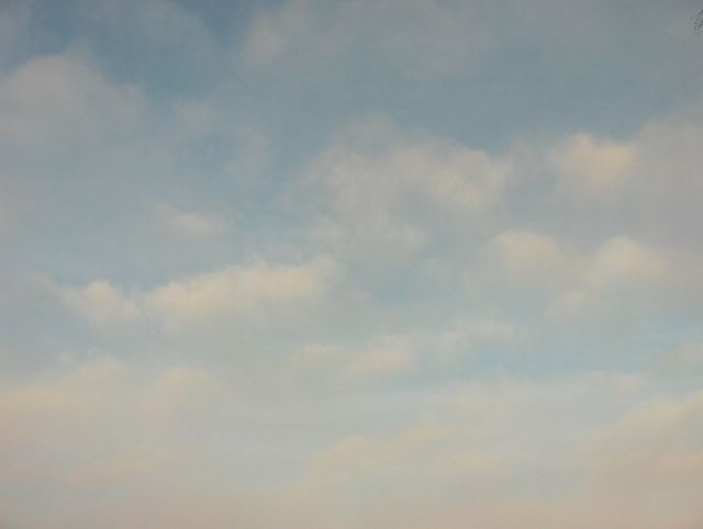
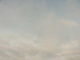
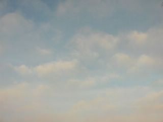
 Kuvassa oli kerros harso- ja verhopilveä, jotka olivat sen verran ohuita, että aurinko kuulsi hieman niiden läpi. Pilvien ja sinisen taivaan sävyt sekoittuivat kiinnostavasti toisiinsa, jolloin pilvien ja kirkkaan taivaan rajaa ei erottanut. Pilvet kuuluivat kahden matalapaineen välissä olleeseen säärintamaan, jonka eteläpuolella (myös kuvauskohteessa) vallitsi lauha ja kuiva luoteistuuli Föhnilmiön ansiosta; pakkasyön jälkeen lämpötila kohosi +0,3 asteeseen. Kuva on otettu Espoon Tapiolassa luoteistaivaalle. Säätilanne: valitse 28.1.2006; Wetter3 A. Wetter3 B.In the picture there was a layer of cirrostratus and altostratus clouds, which were so much thin that the sun shined a bit through them. The colours of the clouds and the blue sky were mixed up interestingly with each other and therefore the boundary between the clouds and the clear sky wasn't visible. The clouds were associated with the weather front, that was between two low pressures. On the southside (at the scene as well) of the front a mild and dry northwesterly wind was prevailing due to the Föhn phenomenon; after a frosty night the temperature rose to +0,3 C. The picture is taken in the district of Tapiola In Espoo (near Helsinki) towards northwestern sky. Weather condition: choose 28.1.2006; Wetter3 A. Wetter3 B.Helsingin Puistolan säätilasto tammikuussa 2006 - Weather chart of Puistola, Helsinki in January 2006.Flickr 1 Flickr 2
 Edellisen yön aikana kylmä rintama ylitti Etelä-Suomen ja melko voimakas pohjoistuuli vallitsi kuvan tilanteessa. Siitä huolimatta sää jopa hieman lämpeni (ylin lämpötila +2,3 astetta) voimistuneen tuulen myötä; ko. ilmamassa oli kiertynyt Norjan vuoriston yli lännestä, jolloin Föhnilmiö vaikutti edelleen. Kun sää lämpenee kylmän rintaman jälkeen, niin ko. rintamaa nimitetään silloin naamioiduksi kylmäksi rintamaksi. Tässä vaiheessa kuivemman polaarisen ilmamassan myötä taivas oli voimakkaan sininen ja sumupilvet olivat kehittyneet kumpupilvien suuntaan. Ne liikkuivat nopeasti tuulessa. Tässä ilmamassassa kumpupilvet ovat hyvin tyypillisiä lämpimämpinä vuodenaikoina, mutta näin leudossa säässä sumupilvet voivat olla kumpupilvien kaltaisia talvellakin. Kuva on otettu Vantaan Tikkurilassa kohti luoteistaivasta. Säätilanne: valitse 27.1.2006; Wetter3 A. Wetter3 B.During the night before a cold front crossed southern Finland and rather strong northerly wind was prevailing in the situation of the photo. Despite of that the weather got even milder (the maximum temperature +2,3 C) due to a strengthened wind; this air mass had been curved over the mountains of Norway from the west and therefore the Föhn phenomenon was affecting further. When the weather warms up after the cold front, then the front is called a masked cold front. At this stage due to a drier polaric air mass the sky was deep blue and the stratus clouds were progressed towards cumulus clouds. They were moving fast with the wind. In this kind of air mass the cumulus clouds are very typical during warmer seasons, but in such a mild weather stratus clouds can resemble cumulus clouds even in winter. The photo is taken in the district of Tikkurila in Vantaa. Weather condition: choose 27.1.2006; Wetter3 A. Wetter3 B.Helsingin Puistolan säätilasto tammikuussa 2006 - Weather chart of Puistola, Helsinki in January 2006.Flickr 1 Flickr 2
 Tässä vaiheessa pohjoisella taivaalla oli lähestymässä lämpimän rintaman pilvivyöhyke (harso- ja verhopilviä), joka nähdään kuvassa olevien vähäisten sumupilvien takana vaaleana kilpenä. Nämä eri pilvilajit paljastivat hyvin aamu- / iltaruskosävyjen erot, koska yhä edelleen aurinko oli tässä vaiheessa vuotta Etelä-Suomessa keskipäivälläkin sen verran matalalla; matalalla olevat sumupilvet saivat paremmin punertavaa sävyä. Tilanteessa vallitsi melko leuto luoteistuuli, koska Föhnilmiö oli vaikuttamassa. Yöllä lämpötila oli tilapäisesti -6,8 astetta selkeämmän taivaan vuoksi. Kuva on otettu Vantaan Tikkurilassa kohti pohjoistaivasta. Säätilanne: valitse 26.1.2006; Wetter3 A. Wetter3 B.At this stage in the northern sky there was nearing a warm front associated belt of clouds (cirrostratus and altostratus clouds), which can be seen in the picture as a light shield behind the minor stratus clouds. These different cloud types revealed finely the differences in the sunset / sunrise colours, because further more at this time of the year the sun shined so low in southern Finland even at noon; low lying stratus clouds got more reddish colour. In the situation there was rather mild northwesterly wind prevailing, because the Föhn phenomenon was affecting. At night the temperature was temporarily -6,8 C due to a clearer sky. The picture is taken in the district of Tikkurila in Vantaa. Weather condition: choose 26.1.2006; Wetter3 A. Wetter3 B.Helsingin Puistolan säätilasto tammikuussa 2006 - Weather chart of Puistola, Helsinki in January 2006.Flickr 1 Flickr 2
 Edelliseen kuvaan verrattuna tässä taivaalla oli lähes yksinomaan sumupilviä ja siksi auringon valon tuomat aamu- / iltaruskosävyt näkyivät tässä harmaiden sävyjen lisäksi. Sumupilvien yläpuolella tosin oli jonkin verran untuva- ja harsopilviä, koska heikko sadealue oli juuri ylittänyt paikan. Kuvan tilanteessa matalapaineen keskus oli ylittämässä Etelä-Suomea. Siten lounainen ilmavirtaus oli heikentynyt ja kuivempi luoteistuuli alkoi vaikuttaa hitaasti; sumupilvet jäivät koko päiväksi. Sää pysyi siten melko leutona ajankohtaan nähden; lämpötila oli nollan tienoilla koko päivän. Kuva on otettu Vantaan Tikkurilassa kohti luoteistaivasta. Säätilanne: valitse 25.1.2006; Wetter3 A. Wetter3 B.As compared to the previous photo here was allmost exclusively stratus clouds in the sky and that's why the sunset / sunrise colours brought by the sunlight were visible here in addition to grey tones. Above the stratus clouds though there were some cirrus and cirrostratus clouds, because a weak precipitation area had just been crossed the scene. In the situation of the photo a center of a low pressure was crossing southern Finland. Therefore southwesterly wind was dying out and drier northwesterly wind started to affect slowly; the stratus clouds stayed the whole day. So the weather stayed rather mild for the time of the year; the temperature was around zero C during the whole day. The photo is taken in the district of Tikkurila in Vantaa. Weather condition: choose 25.1.2006; Wetter3 A. Wetter3 B.Helsingin Puistolan säätilasto tammikuussa 2006 - Weather chart of Puistola, Helsinki in January 2006.Flickr 1 Flickr 2
 Kylmän pakkasjakson jälkeen länsilounainen ilmavirtaus vaikutti jälleen ja kuvassa nähdään sekä ko. leudon ilmamassan sumupilviä, että päivän aikana vaikuttaneen heikon sadealueen sade- ja verhopilviä. Pilvet liikkuivat nopeasti melko voimakkaan tuulen ansiosta ja pilvien osat näkyivät hyvin, koska ilmassassa ei ollut utua tai sumua (yleensä on lauhassa keskileveysasteiden ilmamassassa ja lauhtumisen yhteydessä loppusyksyllä - talvella). Vähäinen sade tuli lumena, koska lämpötila pysyi vielä tässä vaiheessa ylimmilläänkin pakkasella -0,4 asteen verran. Kuva on otettu Vantaan Tikkurilassa kohti luoteistaivasta. Säätilanne: valitse 24.1.2006; Wetter3 A. Wetter3 B. After the cold frosty period west-southwesterly air flow was affecting again and in the picture we see both stratus clouds of the mild air mass and nimbostratus and altostratus clouds of a weak precipitation area, that was affecting during the day. The clouds were moving fast due to a rather strong wind and parts of the clouds were finely visible, because the air mass didn't contain haze or fog (usually it contains in the mild middle latitude air mass and during the rise of temperature in late autumn and winter in Finland). The minor amount of precipitation came in the form of snow, because the temperature was yet further freezing for -0,4 C at highest during this stage. The photo is taken in the district of Tikkurila in Vantaa (near Helsinki) towards northwestern sky. Weather condition: choose 24.1.2006; Wetter3 A. Wetter3 B.Helsingin Puistolan säätilasto tammikuussa 2006 - Weather chart of Puistola, Helsinki in January 2006.Flickr 1 Flickr 2
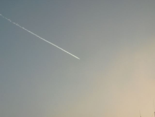
 Samana päivänä myöhemmin edelliseen kuvaan verrattuna lumikuuropilvet olivat tilapäisesti kaikonneet, koska tuulet kävivät välillä enemmän idästä kuin Suomenlahdelta. Kuvassa tosin on hyvin vähän pilvisyyttä oikeassa alakulmassa. Tämä tiesi kovenevaa pakkasta myös päiväsaikaan, koska lumikuuroilla oli ajoittain lauhduttava vaikutus. Etelä-Suomen sisämaassa taivas oli lähes koko kylmän pakkasjakson ajan vähintään näin selkeä. Tässä oli erikoisuutena myös lentokoneen jättämä juova. Kuva on otettu Vantaan Tikkurilassa kohti eteläistä taivasta. Säätilanne: valitse 20.1.2006; Wetter3 A. Wetter3 B.In the same day later as compared to the previous photo the snowshower clouds were temporarily absent, because the winds were coming occasionally more from the east than from The Gulf Of Finland. However in the picture there's very little amount of clouds on the right corner of the photo. This meant sharpening frost also during daytime, because the snowshowers caused the air to get milder occasionally. In the inland areas of southern Finland the sky was at least this clear during allmost all time of the cold frosty period. In here as a peculiar feature there was also a line leaved by an aeroplane. The photo is taken in the district of Tikkurila in Vantaa towards southern sky. Weather condition: choose 20.1.2006; Wetter3 A. Wetter3 B.Helsingin Puistolan säätilasto tammikuussa 2006 - Weather chart of Puistola, Helsinki in January 2006.Flickr 1 Flickr 2
 Tässä on esimerkki hyvin kylmän pakkasilman lumisateesta, jota voi tulla hyvin vähäisistä pilvistä. Kuvauspäivänä pakkasta oli lauhimmillaankin jopa -17,9 astetta ja tilanteessa olleen jo heikentyneen kaakkoistuulen mukana vielä osittain jäättömältä Suomenlahdelta ajautui etelärannikoille lumikuuroja. Tällaisessa pakkasilmassa lumikuuropilvet ovat ulkonäöltään kuin sekoitus kumpukerrospilviä, untuvapilviä ja sumupilviä; kuuropilville tyypillinen cumulusrakenne puuttuu. Kuvassa näkyvät hyvin myös yksittäiset lumihiutaleet vähäisestäkin sateesta, koska taivas oli sen verran kirkas vähäisen pilvisyyden vuoksi. Kuva on otettu Vantaan Tikkurilassa kohti kaakkoistaivasta. Säätilanne: valitse 20.1.2006. Wetter3 A. Wetter3 B.During the very cold frosty air mass here is a example of snowfall, which can appear from very minor clouds. In the photoshooting day the temperature was even at highest -17,9 C and in the situation the allready weakened southeasterly wind brought snowshowers from further partly unfrozen The Gulf Of Finland to the southern coast. In this kind of frosty air the snowshower clouds are like a mixture of stratucumulus, cirrus and stratus clouds by appearance; the cumulus structure typical of cumulonimbus (or showerclouds) clouds is lacking. In the picture there's finely visible separate snowflakes of even slight snowfall, because the sky was so much bright due to the minor clouds. The picture is taken in the district of Tikkurila in Vantaa towards southeastern sky. Weather condition: choose 20.1.2006. Wetter3 A. Wetter3 B.Helsingin Puistolan säätilasto tammikuussa 2006 - Weather chart of Puistola, Helsinki in January 2006.Flickr 1 Flickr 2
 Kuva on otettu samassa paikassa kuin edellinen kuva, mutta kuvaussuunta oli luoteistaivaalle. Tässä nähdään vallinneen kumpukerrospilvilautan ohentuneen, kun kylmä ilmamassa alkoi vallata kuvauspaikkaa idästä käsin yhä enemmän. Näin vähäinenkin pilvisyys antoi kuitenkin vielä heikkoa lumisadetta, mikä voi olla tyypillistä pakkasilmamassassa. Lämpötila laski ko. päivän aikana -9,0 asteesta -18,1 asteeseen. Säätilanne: valitse 18.1.2006; Wetter3 A. Wetter3 B.The picture is taken in the same location as the previous photo, but the direction of the photoshoot was towards northwestern sky. In here we see the prevailing layer of stratocumulus clouds got thinner, when the cold air mass started to invade the scene from the east further more. However even this little amount of clouds gave further slight snowing, which can be typical in a frosty air mass. The temperature dropped from -9,0 C to -18,1 C during the day. Weather condition: choose 18.1.2006; Wetter3 A. Wetter3 B.Helsingin Puistolan säätilasto tammikuussa 2006 - Weather chart of Puistola, Helsinki in January 2006.Flickr 1 Flickr 2
 Kuvassa nähdään paksua kumpukerrospilvi - sadepilvilauttaa ja sumupilviä, joista satoi kohtalaisesti lunta. Tilanteessa oli käynnistymässä voimakas kylmeneminen kovan kaakkoistuulen myötä, kun Suomea oli lähestymässä koillisesta Siperian pakkaskorkeapaine. Pilvisyys liittyi pohjois-eteläsuuntaiseen rintamaan, jonka itäpuolella ko. kylmä ilmamassa oli tulossa. Pilvet liikkuivat hyvin nopeasti kovassa tuulessa ja kuvassa oli heikosti näkyvissä tuulen pöllyttämää lumisadetta. Kuva on otettu Vantaan Tikkurilassa kohti lounaistaivasta. Säätilanne: valitse 17.1.2006; Wetter3 A. Wetter3 B.In the picture we see thick layer of stratocumulus - nimbostratus clouds and stratus clouds, which gave moderately snowing. During this situation a big drop of temperature had been started with strong southeasterly winds, when a frosty high pressure of Siberia was approaching Finland from the northeast. The clouds were associated with a south - north lined front, which held eastwards from itself that advancing cold air mass. The clouds were moving very fast due to the hard wind and in the picture the snowfall was faintly visible as whirled up by the wind. The photo is taken in the district of Tikkurila in Vantaa towards southwestern sky. Weather condition: choose 17.1.2006; Wetter3 A. Wetter3 B.Helsingin Puistolan säätilasto tammikuussa 2006 - Weather chart of Puistola, Helsinki in January 2006.Flickr 1 Flickr 2
 Taivas oli kuvassa täysin selkeä ja ilmamassan kuivuuden vuoksi se näytti myös hyvin siniseltä. Tässä tilanteessa vallitsi kuitenkin hyvin voimakas länsiluoteinen tuuli, joka piti ilman leutona; lämpötila oli ylimmillään +3,7 astetta. Syy tähän oli Föhnilmiö, joka esiintyy tyypillisesti Suomen talvessa matalapaineen kylmän rintaman jälkeen länsituulen yhä edelleen vaikuttaessa; ilma virtaa Norjan vuoriston yli ja lämpenee. Tilanteeseen kuuluu tyypillisesti se, että sumupilvet katoavat, ilma kirkastuu ja lämpötila ei laske, vaikka sää selkenee. Heti tuulen tyynnyttyä lämpötila kuitenkin alkaa laskea nopeasti mihin aikaan päivästä tahansa. Kuva on otettu kohti länsitaivasta Vantaan Tikkurilassa. Säätilanne: valitse 12.1.2006; Wetter3 A. Wetter3 B.The sky was completely clear in the picture and also due to drieness of the air mass the blue colour of the sky was very strong. However in this situation very strong west and west-northwesterly winds were affecting, which kept the air mild; temperature was +3,7 C at highest. The reason for this was a Föhn phenomenon, which appears typically during finnish winter after low pressure associated cold front, where western winds are still affecting; the air flows over mountains of Norway and it warms up. It's typical in the situation here, that the stratus clouds disappear, the air gets clearer and the temperature doesn't get colder allthough the sky is clearing. However as soon as the winds are dying out the temperature is starting to sink fast at any time of the day. The picture is taken in the district of Tikkurila in Vantaa (near Helsinki) towards western sky. Weather condition: choose 12.1.2006; Wetter3 A. Wetter3 B.Helsingin Puistolan säätilasto tammikuussa 2006 - Weather chart of Puistola, Helsinki in January 2006.Flickr 1 Flickr 2
 Seuraavana päivänä sumupilvien kokkareisuus oli selkeämpää edelliseen kuvaan nähden ja voimakas lounaistuuli liikutti pilviä ripeästi. Lounaistuulen aiheutti pohjoiselle Atlantille voimistuneet matalapaineet. Tällainen kokkareisuus edesauttoi värikirjon ja tummuusasteiden näkymistä erinomaisesti ko. pilvikerroksessa, kun aurinko oli vuodenajalle tyypilliseen tapaan edelleen matalalla keskipäivälläkin. Kuva on otettu Vantaan Tikkurilassa kohti luoteistaivasta. Säätilanne: valitse 10.1.2006. Wetter3 A. Wetter3 B.During the next day the lumpyness of the stratus clouds was more visible than in the previous picture and a strong southwesterly wind was moving the clouds in a fast pace. The southwesterly wind was due to strengthened low pressures in the northern Atlantic. This kind of lumpyness helped a range of colours and grades of darkness to stand out very well in this cloud layer, when the sun was shining further so low at noon typically of this season. The photo is taken in the district of Tikkurila in Vantaa towards northwestern sky. Weather condition: choose 10.1.2006; Wetter3 A. Wetter3 B.Helsingin Puistolan säätilasto tammikuussa 2006 - Weather chart of Puistola, Helsinki in January 2006.Flickr 1 Flickr 2
 Kuvassa on runsasta sumupilveä, jossa nähdään heikosti iltaruskosävyä (tai keskipäivän ruskoa). Tässä vaiheessa pitkään vallinnut korkeapaine oli heikentynyt ja antanut tietä voimistuville lounais- ja länsituulille. Tuulet toivat lauhemman sään ja tämän päivän iltaan mennessä lämpötila oli kohonnut +1 asteeseen. Kuvassa pilvet liikkuivat vielä hitaasti heikon tuulen mukana. Aikaisemmassa korkeapainetilanteessa sumupilvet olivat tasaisen lauttamaisia. Nyt ne olivat vähän kokkareisempia. Kuva on otettu samassa paikassa kuin edellinenkin kuva, mutta kohti luoteistaivasta. Säätilanne: valitse 9.1.2006; Wetter3 A. Wetter3 B.In the picture we see plentyfull of stratus clouds, which are coloured weakly with sunset tones (or noon colours). At this stage the longlasting high pressure had been weakened and had been given way to the strengthening west and southwestern winds. The winds brought milder weather and the temperature rose to +1 C by the evening in this day. In the photo the clouds were moving yet in a slow pace with the weak wind. During the previous high pressure the stratus clouds were evenly in layers. Now they were a bit more lumpy. The photo is taken at the same location as the previous one, but towards northwestern sky. Weather condition: choose 9.1.2006; Wetter3 A. Wetter3 B.Helsingin Puistolan säätilasto tammikuussa 2006 - Weather chart of Puistola, Helsinki in January 2006.Flickr 1 Flickr 2
 Tässä vaiheessa Suomen yllä oli vahva korkeapaine ja tuulet olivat tyyntyneet. Lappiin alkoi virrata kuitenkin lannestä voimakkaasti suojasääilmaa. Tällainen ns. keskileveysasteiden ilmamassaan syntynyt korkeapainetyyppi merkitsi tähän vuodenaikaan sitä, että pilvilauttoja oli taivaalla ajoittain runsaasti, kuten erityisesti sumupilviä. Toinen yleinen pilvilaji tässä tilanteessa oli kumpukerrospilvi, jota on kuvassa sumupilvien kanssa yhdessä. Näistä pilvistä satoi paikoitellen hyvin heikosti lunta, mutta niin vähäiset sademäärät eivät olleet mitattavissa. Kuva on otettu kohti pohjoistaivasta Vantaan Tikkurilassa. Säätilanne: valitse 4.1.2006; Wetter3 A. Wetter3 B.In this situatuation a strong high pressure had been formed over Finland and winds had been died out. However it started to flow strongly a mild thaw weather into Lapland. This kind of high pressure type, which had been formed into so called middle latitude air mass meant at this time of the year, that there were plenty of clouds in the sky from time to time like especially stratus clouds. Another common cloud type in this condition were stratocumulus clouds, which appears in the picture with the stratus clouds. From these clouds it was snowing very slightly here and there, but so small amount of precipitation wasn't measureable. The picture is taken in the district of Tikkurila in Vantaa (near Helsinki) towards northern sky. Weather condition: choose 4.1.2006; Wetter3 A. Wetter3 B.Helsingin Puistolan säätilasto tammikuussa 2006 - Weather chart of Puistola, Helsinki in January 2006.Flickr 1 Flickr 2
 Kahdessa edellisessä kuvassa olevien sumupilvien lisäksi samana päivänä taivas oli ajoittain myös lähes tai kokonaan selkeä, kuten kuvassa. Koska vuodenaika oli keskitalvea ja tuuli heikkoa, niin tällaisella pilvisyyden vaihtelulla oli selvä vaikutus lämpötilaan keskellä päivääkin. Pakkanen vaihtelikin päivän aikana -8,9 ja -1,2 asteen välillä. Kuva on otettu Vantaan Tikkurilassa kohti lounaistaivasta. Säätilanne: valitse 3.1.2006; Wetter3 A. Wetter3 B.Besides the stratus clouds of the two previous photos the sky was also clear or allmost clear from time to time during the same day as it's seen in the photo. This variation in clouds affected to the temperature clearly even in the middle of the day, because the season was midwinter and winds were weak. So the temperature changed between -8,9 C and -1,2 C during the day. The picture is taken in the district of Tikkurila in Vantaa towards southwestern sky. Weather condition: choose 3.1.2006; Wetter3 A. Wetter3 B.Helsingin Puistolan säätilasto tammikuussa 2006 - Weather chart of Puistola, Helsinki in January 2006.Flickr 1 Flickr 2
 Tämän sumupilvitrilogian päättää pohjoiseen kuvattu taivasnäkymä Vantaan Tikkurilassa. Tässä on edelleen samoja sumupilviä kuin aikaisemmassa kuvassa, mutta nyt kuvan alareunassa nähdään sumupilvien takana myös heikon säärintaman untuvapilviä. Tämä liittyi nyt koillisessa olleen edellisen päivän matalapaineen rintaman jäänteeseen. Pilvissä näkyy tähän suuntaan kuvattuna hyvin keskipäivän ruskosävyt matalalla olleen auringon takia. Säätilanne: valitse 3.1.2006; Wetter3 A. Wetter3 B.The stratus clouds trilogy is ended here with the northern view of the sky in the district of Tikkurila in Vantaa. Here are the same stratus clouds as in the previous picture, but now there were also cirrus clouds of a weak weather front behind the stratus clouds as it is seen in the lower half of the picture. This was associated with the remain of a front of the previous day's low pressure now located in the northeast. In the clouds as captured in this direction there were finely visible the sunrise / sunset colours of the noon due to the low position of the sun. Weather condition: choose 3.1.2006; Wetter3 A. Wetter3 B.Helsingin Puistolan säätilasto tammikuussa 2006 - Weather chart of Puistola, Helsinki in January 2006.Flickr 1 Flickr 2
 Seuraavana päivänä kuvattuna tässä nähdään lisää lähempänä keskipäivää kuvattuja sumupilviä. Kuvaussuunta ja -paikka ovat samat kuin edellisessä kuvassa. Nyt aurinko oli sen verran korkeammalla, että pilvien aamuruskosävyt olivat lähes olemattomia tullakseen kuitenkin parin tunnin kuluttua uudestaan iltaruskona. Tilanteessa korkeapaine oli vahvistumassa Etelä-Suomen ylle ja tuulet olivat jo tyyntyneet. Alempana on lisää esimerkkejä keskipäivän ruskoväreistä joulukuulta. Säätilanne: valitse 3.1.2006. Wetter3 A. Wetter3 B.As pictured in the next day we see here more stratus clouds photographed nearer the noon time. The shooting direction and the location are both the same as in the previous photo. Now the sun was in so high position that the sunrise colours of the clouds were allmost disappeared only to reappear in couple of hours as the sunset colours. In the situation a high pressure was strengthening over southern Finland and the winds had allready been calmed down. Below there's more examples of sunrise / sunset colours at noon time during December. Weather condition: choose 3.1.2006; Wetter3 A. Wetter3 B.Helsingin Puistolan säätilasto tammikuussa 2006 - Weather chart of Puistola, Helsinki in January 2006.Flickr 1 Flickr 2
 Kuvauspäivän tilanteessa lauhat etelä- ja lounaistuulet vaikuttivat vielä, vaikka Suomen ylle alkoi vahvistua korkeapaineen selänne. Taivaalla liikkui kuitenkin edelleen sumupilviä, joista tässä on eräs iltaruskon (myös ns. keskipäiväruskovärejä tähän aikaan vuodesta) värjäämä esimerkki. Tässä vaiheessa lämpötila oli vielä ylimmillään +1,3 astetta, mutta iltaan mennessä pakastui hieman alkupäivän sadealueen (lunta, räntää ja vettä) jälkeen sään seljettyä osaksi. Sateen aiheutti hyvin pieni matalapaine idän korkeapaineen länsireunalla. Kuva on otettu kohti lounaistaivasta Vantaan Tikkurilassa. Säätilanne: valitse 2.1.2006; Wetter3 A. Wetter3 B.During the situation of the photoshooting day mild air flows from south and southwest were affecting, although a high pressure was strengthening over Finland. However there were further stratus clouds moving about in the sky. Here is one example of those with the sunset colours (also noon colours so to speak in this time of the year). At this time the temperature was +1,3 C at highest, but it turned a bit freezing by the evening after a precipitation area (snow, sleet and rain) of the early day as the weather got partly clear. The precipitation was caused by a very small low pressure on the western side of a eastern high pressure. The photo is taken towards southwestern sky in the district of Tikkurila in Vantaa (near Helsinki). Weather condition: choose 2.1.2006; Wetter3 A. Wetter3 B. Helsingin Puistolan säätilasto tammikuussa 2006 - Weather chart of Puistola, Helsinki in January 2006.Flickr 1 Flickr 2