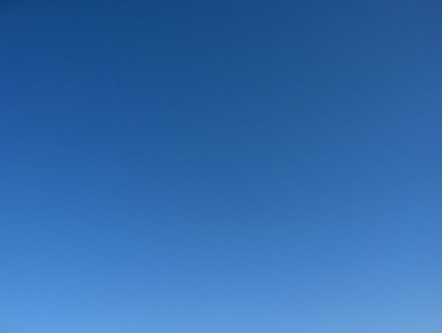
Kuvassa nähdään hentoja untuva- ja harsopilvinauhoja, jotka peittivät tilanteessa ja myös melkein koko päivän ajan koko taivaan sumentaen sen sinisyyttä harmaaseen suuntaan. Aurinko kuitenkin paistoi melko hyvin tämän kerroksen läpi. Aamulla ja illalla nämä pilvet tuottivat ruskovärejä. Kuva on otettu Espoon Tapiolassa itätaivaalle. Pilvet johtuivat Suomen lounaispuolella olleesta hyvin heikosta okluusiorintamasta, joka yritti tulla kuvausalueellekin. Koillisessa Pohjois-Venäjällä vahvistunut korkeapaine esti rintamaa kuitenkin pääsemästä Suomeen, vaikka lännessä sen menoa olikin vauhdittamassa iso matalapaine pohjoisella Atlantilla. Korkeapaineen myötä heikot etelä- ja kaakkoistuulet olivat vallitsevia ja päivä päivältä lämpenevä keskileveysasteiden ilmamassa oli kehittymässä; ko. päivän ylin lämpötila oli kuvauspaikalla +13,3 astetta ja sisämaassa merituulen ulottumattomissa +15 astetta ylitettiin ensimmäisen kerran ko. keväänä. Säätilanne: valitse 25.4.2006; Wetter3 A. Wetter3 B.
In the picture we see weak stripes of cirrus and cirrostratus clouds, which shadowed in the situation and also during allmost all day the whole sky as blurring the blueness of it towards a grey direction. However the sun was shining rather well through this layer. In the morning and in the evening these clouds produced sunrise and sunset colours. The photo is taken in the district of Tapiola in Espoo towards eastern sky. The clouds resulted of a very weak occluded front situated in the southwestern side of Finland. The front tried to come over photoshooting scene as well. However in the northeast in northern Russia a strengthening high pressure prevented the front to come in Finland allthough a big low pressure in the west in Atlantic was boosting the movement of it. Due to the high pressure weak south and southeasterly winds prevailed and a day by day warming middle latitude air mass was forming; the maximum temperature of the day was +13,3 C in the photoshooting scene and in inland areas unreached by the sea breeze +15 C was topped for the first time this spring. Weather condition: choose 25.4.2006; Wetter3 A. Wetter3 B.
Helsingin Puistolan säätilasto huhtikuussa 2006 - Weather chart of Puistola, Helsinki in April 2006.
Flickr 1 Flickr 2
Tehoisa lämpösumma - The Effective Temperature Sum: 2,5 
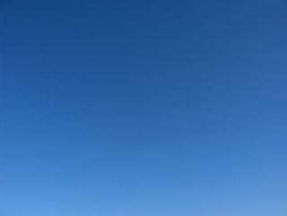
Tässä vaiheessa Suomen alueelle ja sen itäpuolelle oli vahvistunut korkeapaine. Sen myötä 21. päivän pohjoistuuli oli heikentynyt ja kääntynyt lounaaseen. Ko. päivän ylin lämpötila oli +11 astetta, joten lämpenevä tendenssi oli alkamassa. Tuulet olivat heikkoja, mutta korkeapainetilanteessa vielä kylmästä ja yhä edelleen sulavasta Suomenlahdesta johtuen merituuli oli iltapäivisin ajoittain kohtalaista. Kuvan tilanteessa oli täysin selkeää ja 21. päivänä olleiden kumpupilvien jälkeen taivaalla oli muutenkin hyvin vähän pilviä; ainoastaan vähän untuvapilviä ja sisämaassa iltapäivän kumpupilviä. Tässä vaiheessa taivaan sinisyys oli vielä voimakasta, koska keskileveysasteiden ilmamassalle tyypillinen utu ei vielä ollut sumentamassa taivasta; tilanne alkoi kehittymään tästä vähän utuisempaan suuntaan. Kuva on otettu Espoon Tapiolassa pohjoistaivaalle. Säätilanne: valitse 24.4.2006; Wetter3 A. Wetter3 B.
At this stage over Finland and to the eastern side of it a high pressure had been strengthened. Due to that the northerly wind of the 21st day had been weakened and turned to south. The maximum temperature of the day was +11 C, so therefore a warming tendency was starting. Winds were weak, but due to cold and still melting The Gulf Of Finland the sea breeze was occasionally moderate during afternoons. In the situation of the picture it was completely clear and after cumulus clouds of the 21st day there was also otherwise very little amount of clouds; only small amounts of cirrus and in inland areas also cumulus clouds of the afternoon. At this stage the blueness of the sky was strong, because the typical haze of the middle latitude air mass wasn't yet blurring the sky; the condition started to progress towards a little hazier direction from here. The picture is taken in the district of Tapiola in Espoo towards northern sky. Weather condition: choose 24.4.2006; Wetter3 A. Wetter3 B.
Helsingin Puistolan säätilasto huhtikuussa 2006 - Weather chart of Puistola, Helsinki in April 2006.
Flickr 1 Flickr 2

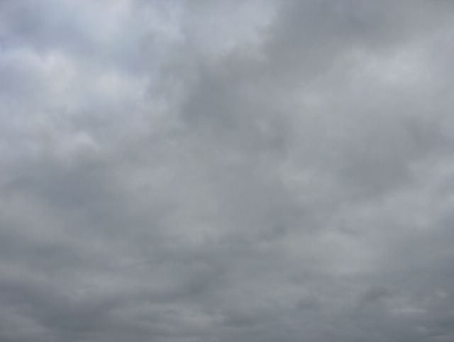
Etelä-Suomen yllä oli nyt pieni lounaasta saapunut matalapaine. Siihen liittynyt okluusiorintama toi kohtalaista sadetta kuvauspaikalle Espoon Tapiolaan iltapäivällä. Kuvan tilanteessa sade oli juuri tauonnut, mutta taivas oli vielä täysin pilvinen. Kuvassa nähdään kerros sumu- ja kumpukerrospilviä sekoittuneena toisiinsa ja niiden yllä oli edelleen sadepilviä. Siksi ko. hetken iltaruskon värit eivät näkyneet alemmissa pilvissä. Kuva on otettu kohti itätaivasta. Sade tuli kokonaan vetenä, mutta matalapaineen jälkipuolella myöhemmin illalla ja yöllä tulleista kuuroista osa satoi myös räntänä, koska ilmamassa oli viileää (ylin lämpötila ko. päivänä +7,6 ja yöksi lämpötila laski n. +1 asteeseen voimistuneessa pohjoistuulessa). Räntäsateista ei jäänyt kuitenkaan mitään maahan. Säätilanne: valitse 20.4.2006; Wetter3 A. Wetter3 B.
Over southern Finland there was now a small low pressure, which came from the southwest. A occluded front associated with it brought moderate rain to the photoshooting scene in the district of Tapiola in Espoo during the afternoon. In the situation of the picture the rain had just been ceased, but the sky was further completely cloudy. In the picture we see a layer of stratus and stratocumulus clouds as mixed up with each other and above them there was further nimbostratus clouds. That is why this moment's setting sun associated colours didn't show on the lower clouds. The picture is taken towards eastern sky. The precipitation came entirely in the form of rain, but on the afterside of the low pressure some of the showers fell also as sleet, because the air mass was cool; the maximum temperature of the day was +7,6 C and for the night the temperature dropped to about +1 C in a strengthened northerly wind. However nothing was left to the ground from the fallen sleet. Weather condition: choose 20.4.2006; Wetter3 A. Wetter3 B.
Helsingin Puistolan säätilasto huhtikuussa 2006 - Weather chart of Puistola, Helsinki in April 2006.
Flickr 1 Flickr 2
 Tässä oli lähes samanlainen säätilanne kuin edellisessä kuvassa, mutta nyt kuvan alareunassa nähdään pilvilautan reunaa. Kuva on otettu Espoon Tapiolassa kohti koillistaivasta. Kylmältä mereltä tässäkin tullut pilvilautta (lähinnä kumpukerrospilviä ja sumupiliviä) ulottui vain n. 10 - 20 kilometriä sisämaahan päin ja sisämaassa vallitsivat samaan aikaan lähinnä kumpu- ja kuuropilvet. Näinä kahtena päivänä näitä kuvien pilvilauttoja ei kuitenkaan ollut koko ajan, vaan sää oli ajoittain selkeämpää tai sadekuuro-, kumpu- ja hahtuvapilvetkin olivat tyypillisempiä. Ilmamassa oli edelleen melko viileää ajankohtaan nähden (ylin lukema oli +7,3 C), mutta runsaan pilvisyyden ja tuulenkin ansiosta yölämpötila laski vain -0,1 pakkasasteeseen. Selkeämmillä alueilla sisämaassa oli pari astetta kylmempää. Säätilanne: valitse 19.4.2006; Wetter3 A. Wetter3 B.In here was allmost the same kind of weather condition as in the previous picture, but now we see the edge of the cloud layer in the lower side of the photo. The picture is captured in the district of Tapiola in Espoo towards northeastern sky. The layer of clouds (mainly stratocumulus and stratus clouds) floated from the cold sea also here were reaching towards the inland areas only about 10 to 20 kilometres and in the inland areas prevailed mainly cumulus and cumulonimbus clouds at the same time. However during these two days these layers of clouds in the pictures didn't appear all the time, but instead it was occasionally clearer or cumulonimbus, cumulus and also altocumulus clouds were more typical. The air mass was further rather cool considering the time of the year (the maximum reading was +7,3 C), but due to the plentyfull clouds and also the wind the temperature turned freezing at night only to -0,1 C. In the clearer skied areas in inland it was couple of degrees colder. Weather condition: choose 19.4.2006; Wetter3 A. Wetter3 B.Helsingin Puistolan säätilasto huhtikuussa 2006 - Weather chart of Puistola, Helsinki in April 2006.
Flickr 1 Flickr 2
 Nyt edellisen päivän okluusiorintaman jälkeen oli kuvauspaikalle Espoon Tapiolaan virrannut viileämpää ilmaa lounaasta melko voimakkaan lounaistuulen myötä. Ko. ilmamassassa esiintyi sadekuuroja (paikoin myös rantää, koska päivän ylin lämpötila oli vain +6,6 astetta). Tässä kuvattuna koillistaivaalle nähdään yhtenäistä kerrosta sumupilveä, joka oli kehittynyt hieman kumpukerrospilven suuntaan kevään auringon lämmittävän vaikutuksen vuoksi. Tämä pilvilautta tuli kylmältä mereltä (vielä osaksi jäinen Suomenlahti) ja se ehkäisi sadekuuroja ko. paikalla. Sumupilvet ja sumut ovat rannikolla tyypillisiä monissa säätilanteissa tähän aikaan vuodesta, kun kosteaa ja etenkin myös lämmintä ilmaa virtaa kylmän alustan (ko. meri) yli. Säätilanne: valitse 18.4.2006; Wetter3 A. Wetter3 B.Now after the occluded front of the previous day a cooler air had been flowed with a rather strong southwesterly wind to the scene in the district of Tapiola in Espoo. In this air mass showers appeared (also locally sleet, because the maximum temperature of the day was only +6,6 C). As pictured here towards northeastern sky we see even layer of stratus clouds, which had been transformed a bit towards stratocumulus clouds due to a warming effect of the spring sun. This layer of clouds came from the cold sea (yet partly frozen The Gulf Of Finland) and that prevented showers in this place. The stratus clouds and fogs are typical by the coast during this time of the year in many weather situations, as moist and especially also warm air flows over a cold surface (the mentioned sea). Weather condition: choose 18.4.2006; Wetter3 A. Wetter3 B.Helsingin Puistolan säätilasto huhtikuussa 2006 - Weather chart of Puistola, Helsinki in April 2006.
Flickr 1 Flickr 2
 Edellisen kuvan jälkeen Etelä-Suomi oli ollut lähinnä heikon korkeapaineen selänteen alueella pienien matalapaineiden kierrettyä vaihtelevasti alueen reunoilla. Pilvisyys oli ollut vaihtelevaa (lähinnä kaikkia muita pilvilajeja paitsi kumpu-, sade- ja kuuropilviä) ja sää lämpeni vähän niin, että kevään korkein lukema (+9,4 astetta) tähän mennessä saavutettiin 15. päivänä. Sadetta ei saatu tämän kuvan kuvauspaikalle Espoon Tapiolaan 13. päivän jälkeen, mutta kuvauspäivänä kuurottaisen vesisateen alue liikkui paikan yli iltapäivällä ja illalla lännessä olleen matalapaineen okluusiorintaman myötä. Kuvassa nähdään illan lähes viimeisen sadekuuropilven jäännettä (alkoi muistuttaa kumpukerrospilveä) kuvattuna länsitaivaalle kohti auringonlaskua. Mukana olivat myös tummat sumupilvet taivaan rannassa. Auringonlasku värjäsi pilviä hienosti oranssiksi, koska heikko sade sumensi samalla näkymää. Kuvausajankohdasta havaitaan myös se, että päivän pituus oli kasvanut jo melko myöhään iltaan. Säätilanne: valitse 17.4.2006; Wetter3 A. Wetter3 B.After the previous picture southern Finland were mainly in the area of a weak ridge of high pressure as small low pressures circled around the edges of the area in variable ways. The cloudyness had been variable (mainly all types of clouds except cumulus, nimbostratus and cumulonimbus clouds) and the weather warmed up so, that the highest reading (+9,4 C) of the spring so far was reached at the 15th day. Precipitation didn't come in the scene of this picture in the district of Tapiola in Espoo after the 13th day, but in the photoshooting day a showery area of rain crossed the scene in the afternoon and evening due to a occluded front of a low pressure situated in the west. In the picture we see remains of a allmost last cumulonimbus cloud (started to resemble stratocumulus clouds) of the evening as pictured towards the sunset in the western sky. Among there was also dark stratus clouds on the horizon. The sunset coloured the clouds finely, because a weak rain blurred the scenery at the same time. From the time of the photoshoot we can observe also, that the length of the day had been increased allready into rather late evening. Weather condition: choose 17.4.2006; Wetter3 A. Wetter3 B.Helsingin Puistolan säätilasto huhtikuussa 2006 - Weather chart of Puistola, Helsinki in April 2006.
Flickr 1 Flickr 2
 Vähän vajaa tuntia myöhemmin edelliseen kuvaan verrattuna pilvipeite oli alkanut rakoilla merkkinä siitä, että Suomen eteläpuolelle oli alkanut muodostumaan pieni korkeapaine. Kuva on otettu samassa paikassa ja samaan suuntaan kuin edellinen kuva. Pilvisyyden vähänemisen myötä päivälämpötilat alkoivat kohota, mutta yöpakkaset jatkuivat vielä. Edellisenä päivänä oli satanut lumikuuroja viileämmän ilmamassan myötä, mutta auringon tultua pian selvästi aikaisempaa enemmän esille, niin tuntui kevät jo selvästi keväältä huolimatta vielä melko viileästä ilmamassasta. Koko alkukuun ajan tähän asti oli ollut suorastaan poikkeuksellisen pilvistä runsaiden sumupilvien ja useiden sadealueiden vuoksi. Aurinkoinen sää tiesi jäljellä olleiden lumien kiihtyvää sulamista ja aurinkoisimmilla paikoilla myös ensimmäisten kasvien heräämistä kunnolla eloon; mm. monet varhaiset sipulikasvit, kuten krookukset (Crocus sp.). Varsinainen kasvukausi ei silti vielä alkanut. Säätilanne: valitse 11.4.2006; Wetter3 A. Wetter3 B.A little less than an hour later as compared to the previous photo the cloud cover had been started to break up as a sign for the fact, that in the southern side of Finland a small high pressure had been started to form. This picture is taken at the same location and towards the same direction as the previous photo. Due to the decreasing of the clouds the daytime temperatures started to rise, but the night temperatures stayed yet freezing. During the previous day there had been snowshowers due to the cooler air mass, but as the sun soon was much more better exposed than before, so the spring felt allready clearly like spring despite of the further rather cool air mass. During the whole early month the weather had been even unusually cloudy due to the plentyfull stratus clouds and many precipitation areas. The sunny weather meant fastened melting of the remaining snow and on the sunniest spots a proper awakening of the first plants; for example many early bulbous plants, like the crocuses (Crocus sp.). The actual growing season wasn't starting yet though. Weather condition: choose 11.4.2006; Wetter3 A. Wetter3 B.Helsingin Puistolan säätilasto huhtikuussa 2006 - Weather chart of Puistola, Helsinki in April 2006.Flickr 1 Flickr 2
 Kuvassa nähdään melko voimakkaasti kokkareista sumupilveä ja kumpukerrospilveä sekoittuneena toisiinsa. Kuva on otettu Espoon Tapiolassa koillistaivaalle. Tuulet olivat tilanteessa enimmäkseen heikkoja ja kääntymässä päivän mittaan lounaasta luoteeseen. Tähän aikaan vuodesta termiikki alkoi vaikuttamaan jo monissa eri säätilanteissa yhä enemmän voimistuvan auringonsäteilyn vuoksi. Tuo pilvien kokkareisuus kertoi juuri siitä ja koska tässä polaarisessa ilmamassassa ei ollut utua, niin pilvien muodot tulivat hyvin esille. Itse ilmamassa ei ollut tässä vaiheessa kovin keväistä, koska aikaisempina päivinä lännessä ollut matalapaine oli nyt heikentyneenä Suomen yllä ja sen ympäri oli päässyt jälleen tavanomaista viileämpää ilmaa myös kuvauspaikalle; ko. päivän ylin lämpötila oli vain +3,3 astetta. Kaksi päivää aikaisemmin Etelä-Suomeen oli päässyt em. matalapaineen etupuolella tilapäisesti keväisempää ilmaa etelästä ja lounaasta, jolloin saavutettiin kevään tähän mennessä korkein lukema +7,1 astetta. Säätilanne: valitse 11.4.2006. Wetter3 A. Wetter3 B. In the picture we see rather strongly lumpy stratus clouds mixed up with the stratocumulus clouds. The picture is taken in the district of Tapiola in Espoo towards northeastern sky. Winds were mostly weak in the situation and were turning from the southwest to the northwest during the day. In this time of the year the thermal started allready to affect in many different weather conditions due to the further more strengthening radiation of the sun. That lumpyness of the clouds was told by just that and because this polaric air mass didn't contain haze, so the shapes of the clouds came finely visible. The air mass itself wasn't so springlike at this moment, because a low pressure situated in the west during previous days was now weakened over Finland and around it a cooler than the average air had been brought also to the photoshooting scene; the maximum temperature of the day was only +3,3 C. Two days earlier on the foreside of the mentioned low pressure more springlike air had been brought temporarily to southern Finland from the south and southwest and therefore the highest reading of the spring so far was reached; +7,1 C. Weather condition: choose 11.4.2006; Wetter3 A. Wetter3 B.Helsingin Puistolan säätilasto huhtikuussa 2006 - Weather chart of Puistola, Helsinki in April 2006.
Flickr 1 Flickr 2
 Pitkään jatkunut melkein koko ajan täysin pilvinen sää päättyi viimeinkin ko. päivänä iltapäivällä, kun Etelä-Suomen vieressä ja yllä ollut pieni matalapaine sulautui lännessä olleeseen laajempaan matalapaineeseen ja kuivempi lounaistuuli virisi vähän. Sumupilvet kaikkosivat melkein kokonaan ja kuurosateetkin vähenivät, joten kuvaushetkellä taivaalla oli jäljellä enää komeaa kerrosta kumpukerrospilveä. Tässä sitä on kuvattuna länsitaivaalle Espoon Tapiolassa. Pilvien vähenemisen myötä iltapäivän lämpötila kohosi vähän korkeammaksi kuin edellisinä päivinä; ylin lämpötila oli +3,2 astetta. Ilmamassa ei silti vielä tässä vaiheessa lämmennyt kunnolla eivätkä hyvin pilviset säätilanteet päättyneet tähän. Säätilanne: valitse 6.4.2006; Wetter3 A. Wetter3 B.A longlasting and allmost all the time completely cloudy weather ended finally in this day during the afternoon, when a small low pressure near and over southern Finland fused into a wider low pressure in the west and a drier southwesterly wind picked up a bit. The stratus clouds disappeared allmost completely and the showery precipitation decreased as well, so in the photoshooting moment there were only a some layer of showy stratocumulus clouds left in the sky. In here they are captured towards western sky in the district of Tapiola in Espoo. Due to the decreasing of the clouds the afternoon temperature rose a bit higher than in previous days; the maximum temperature was +3,2 C. The air mass didn't got properly warmer yet at this stage though and very cloudy weather conditions didn't stop here. Weather condition: choose 6.4.2006; Wetter3 A. Wetter3 B.Helsingin Puistolan säätilasto huhtikuussa 2006 - Weather chart of Puistola, Helsinki in April 2006.
Flickr 1 Flickr 2
 Puolisen tuntia myöhemmin kuvattuna samana päivänä kuin alempi kuva nähdään tässä esimerkki ko. säätilanteessa tulleista lumikuuroista. Ilmamassa oli sen verran kylmää koko kuun alun tähän asti, että sateet tulivat osaksi myös lumena. Ko. päivän alin lämpötila oli 0,0 ja ylin +1,2 astetta; pilvisyyden ja tasaisten tuuliolojen vuoksi vuorokausivaihtelu oli pientä. Kevään tulosta kertoi kuitenkin se, että nämä sateet olivat selkeämmin kuurottaisia kuin vastaavassa tilanteessa keskemmällä talvea olisi ollut. Vomakkaampi auringonsäteily voimisti siis jo sateita ja muodosti sadealuesta kokkareisempia. Kevättä ilmaan toi sateen olomuodosta huolimatta myös lisääntynyt valoisuus; huomaa, kuva on otettu myöhään iltapäivällä ja kohti taivaan lakea. Em. johtuen kirkkaampi taivas toi paremmin esille näiden kuurojen lumihiutaleet ja heikossa tuulessa ne näkyivätkin kauniin tasaisesti. Lisäksi tämän märän lumisateen olemukseen kuuluivat pakkaslumisadetta isommat hiutaleet. Säätilanne: valitse 4.4.2006; Wetter3 A. Wetter3 B.About half an hour later as pictured in the same day as the previous photo we see here an example of the snowshowers, which came in this weather situation. The air mass was cold in such a way for all of the early month to this point, that part of the precipitation came also in the form of snow. The minmum temperature was 0,0 C and the maximum +1,2 C during this day; due to the clouds and steady wind conditions the cycle of night and daytime temperatures were small. However the arrival of spring was manifested by the fact, that the precipitation was more showery than it would have been in the more middle of winter. In other words the more powerfull radiation of the sun strengthened allready the precipitation and made the precipitation areas to appear more lumpy. Despite the form of the precipitation the increased amount of light brough also spring into the air; note, the photo is taken late in the afternoon and towards the zenith of the sky. Due to the mentioned fact the brighter sky brought better visible these snowflakes of the showers and in the weak wind they showed beautifully even. In addition to the manner of this wet snowfall belonged bigger flakes than during a dry frosty snowfall. Weather condition: choose 4.4.2006; Wetter3 A. Wetter3 B.Helsingin Puistolan säätilasto huhtikuussa 2006 - Weather chart of Puistola, Helsinki in April 2006.
Flickr 1 Flickr 2
 Koko kuun alun tähän asti Suomen yllä ja sen länsipuolella oli vallinnut tavanomaista viileämmässä ilmamassassa matalapaine, joka kierrätti lähinnä lounaasta yhä myös ko. päivänä kuurottaisia sateita kuvauspaikalle Espoon Tapiolaan. Tässä ja ylemmässä kuvassa nähdään ko. tilanteen kaksi eri versiota samana päivänä. Tässä aikaisemmin otetussa kuvassa ei satanut, mutta taivaalla oli paksu kerros sumupilviä ja niiden yläpuolella vaihtelevasti etenkin kumpukerros-, sade- ja kuuropilviä, kuten koko kuun aikana oli ollut. Tuulet olivat enimmäkseen heikkoja tai kohtalaisia koko kuun alun, joten pilvet eivät liikkuneet nopeasti taivaalla. Tämä kuva on otettu etelätaivaalle. Säätilanne: valitse 4.4.2006; Wetter3 A. Wetter3 B.All of the early month to this point there had been prevailed over and western side of Finland in a cooler than normal air mass a low pressure, which circulated mostly from the southwest showery precipitation further to the photoshooting scene in the district of Tapiola in Espoo also during this day. In here and in the picture above we see two different versions of the situation in the same day. In this photo captured earlier it wasn't raining, but there were a thick layer of stratus clouds and above them variably especially stratocumulus, nimbostratus and cumulonimbus clouds as it had been the case for all of the early month. Winds were mostly weak or moderate for the whole early month, so the clouds weren't moving fast in the sky. This picture is taken towards southern sky. Weather condition: choose 4.4.2006; Wetter3 A. Wetter3 B.Helsingin Puistolan säätilasto huhtikuussa 2006 - Weather chart of Puistola, Helsinki in April 2006.
Flickr 1 Flickr 2